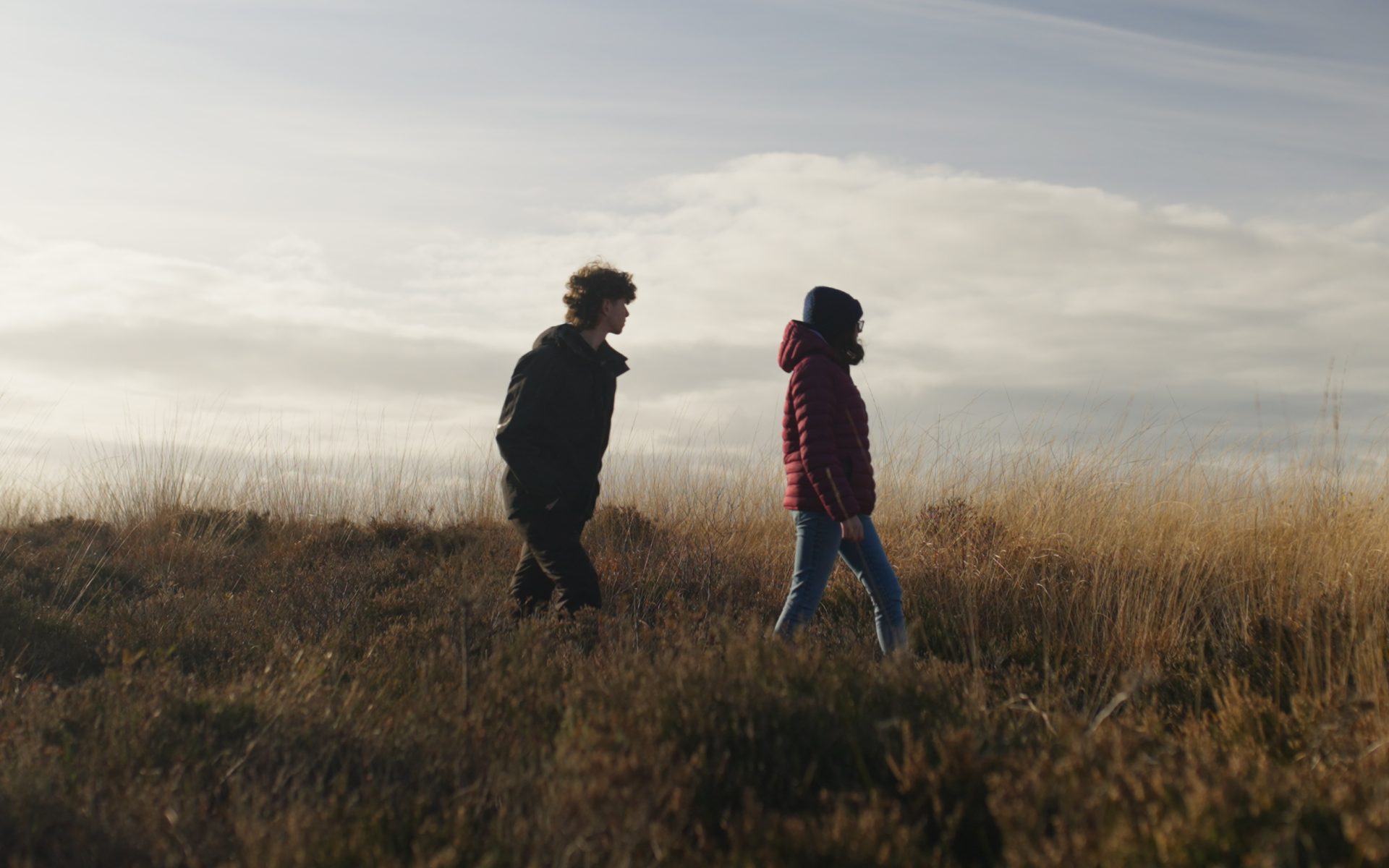
Changing Tides
Chapter One:Introduction
The Dyfi coastline is in perpetual flux. It has changed and adapted over millennia, and people and communities have adapted along with it.
To thrive in the years to come, we believe that we must continue to adapt – and we have a better chance of succeeding if we work together to achieve that.

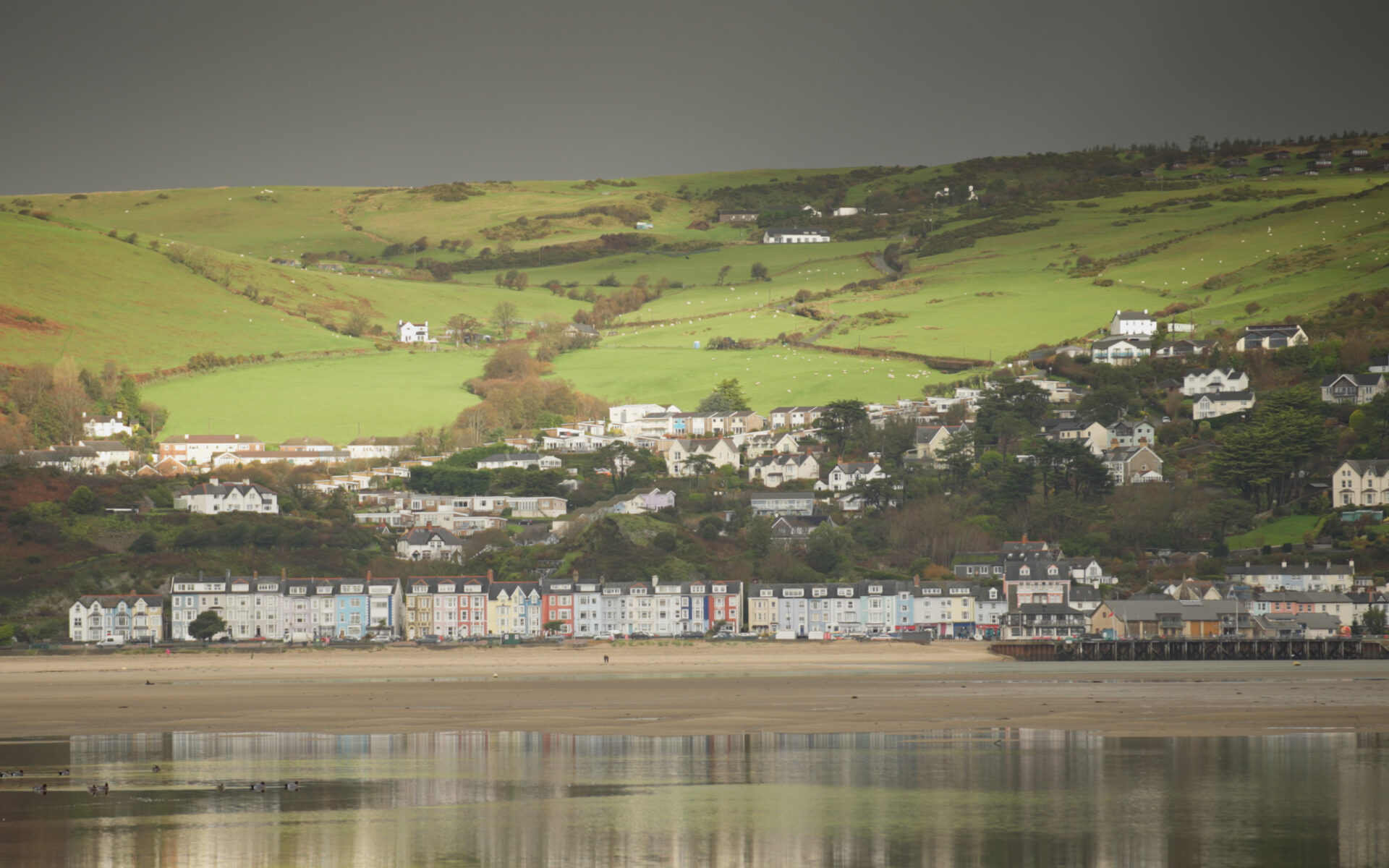
The Dyfi is an internationally significant site and sits within the Pen Llŷn a’r Sarnau Special Area of Conservation (PLAS SAC). It’s also a marine protected area and a designated UNESCO biosphere. The Dyfi Estuary is part of a national nature reserve which incorporates Cors Fochno, Ynyslas sand dunes, the RSPB Ynys-Hir Nature Reserve and the Dyfi Osprey Project.
A collaborative effort to build
Between 2020 and 2022, Tir Canol – a partnership of people and organisations working to create positive environmental and social outcomes – met with local residents and organisations across the Dyfi with a shared, deep desire to engage positively in addressing the challenges the future holds.
The ambition is to think globally but make an impact locally, embrace the ideas and experiences of others, and build on the practical assets at our fingertips.
Enabling ourselves and our community
With the support of Tir Canol, our core co-production group was formed. We’re made up of residents from across the Dyfi Estuary with diverse perspectives and lived experiences, ranging from farmers and researchers to marketers and artists. We think it’s important to place people at the centre of our thinking and action planning.
We’re on a journey to educate ourselves and others within our community on the possible futures of our beloved coastline in the face of rising sea levels and . This handbook – the first of its kind created using a coproduction approach – outlines the context and scope of our work, exploring the history and geography of the Dyfi coast, its habitats and species, and why it’s so unique. It also includes information on the policies, plans and modelling of the coast, and gives voice to some of the people who live and work here.
Changing Tides is a collaboration within our communities, giving local people control and ownership of their own priorities. It’s about sharing mutually identified practices and knowledge with pride to improve our area for nature, for ourselves, for our visitors and customers, and for future generations.
Chapter Two:History & geography of the Dyfi
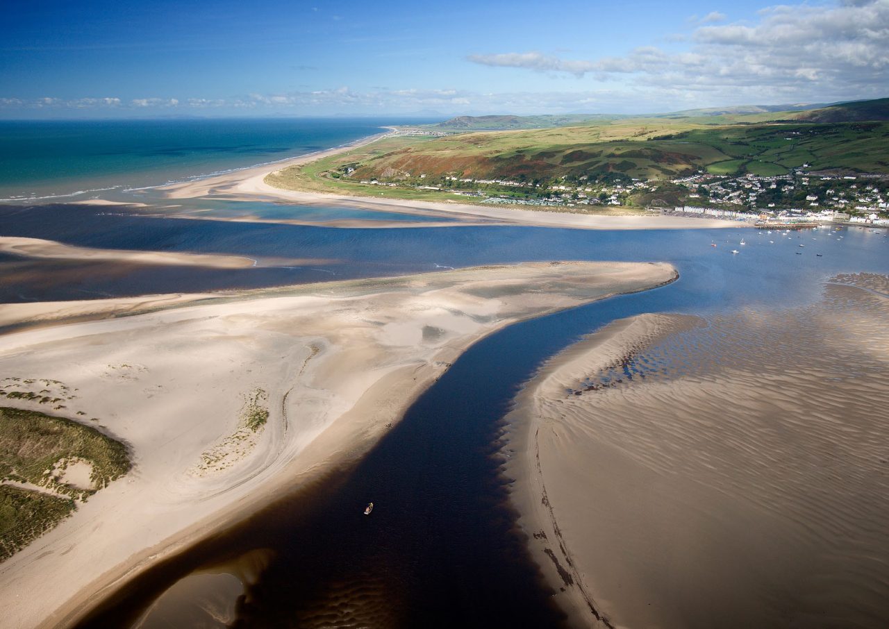
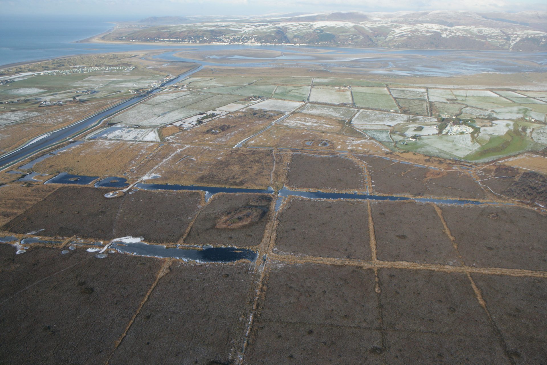
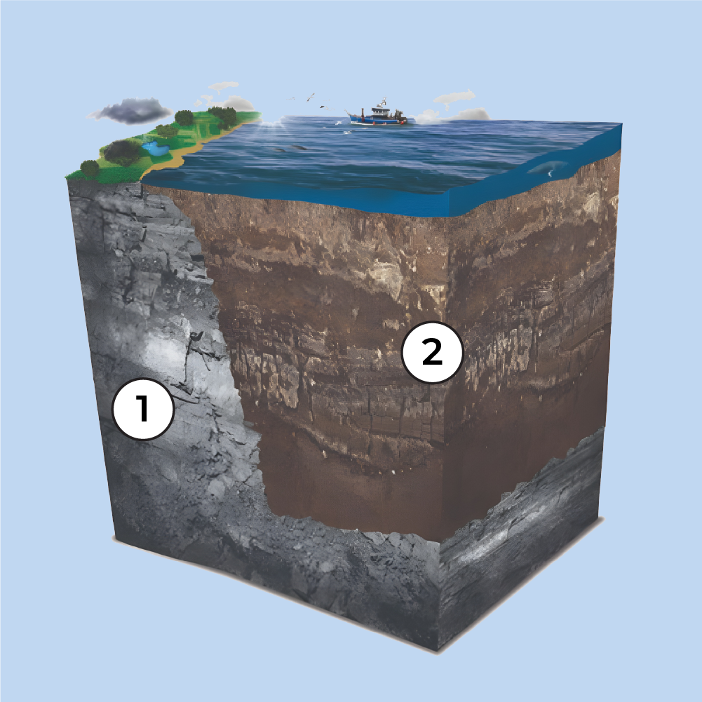
The Dyfi Estuary and (the area of land where all the rain and streams eventually flow into the same river), lies on the north Cardigan Bay coast of Mid Wales.

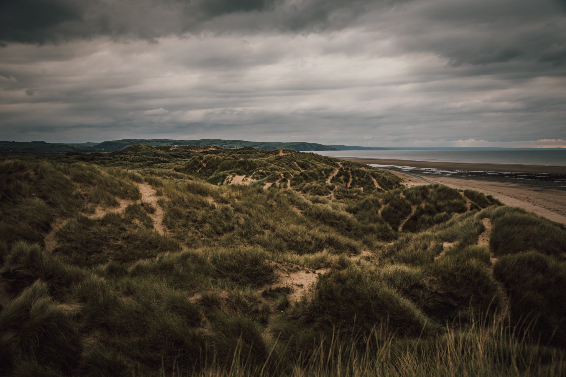
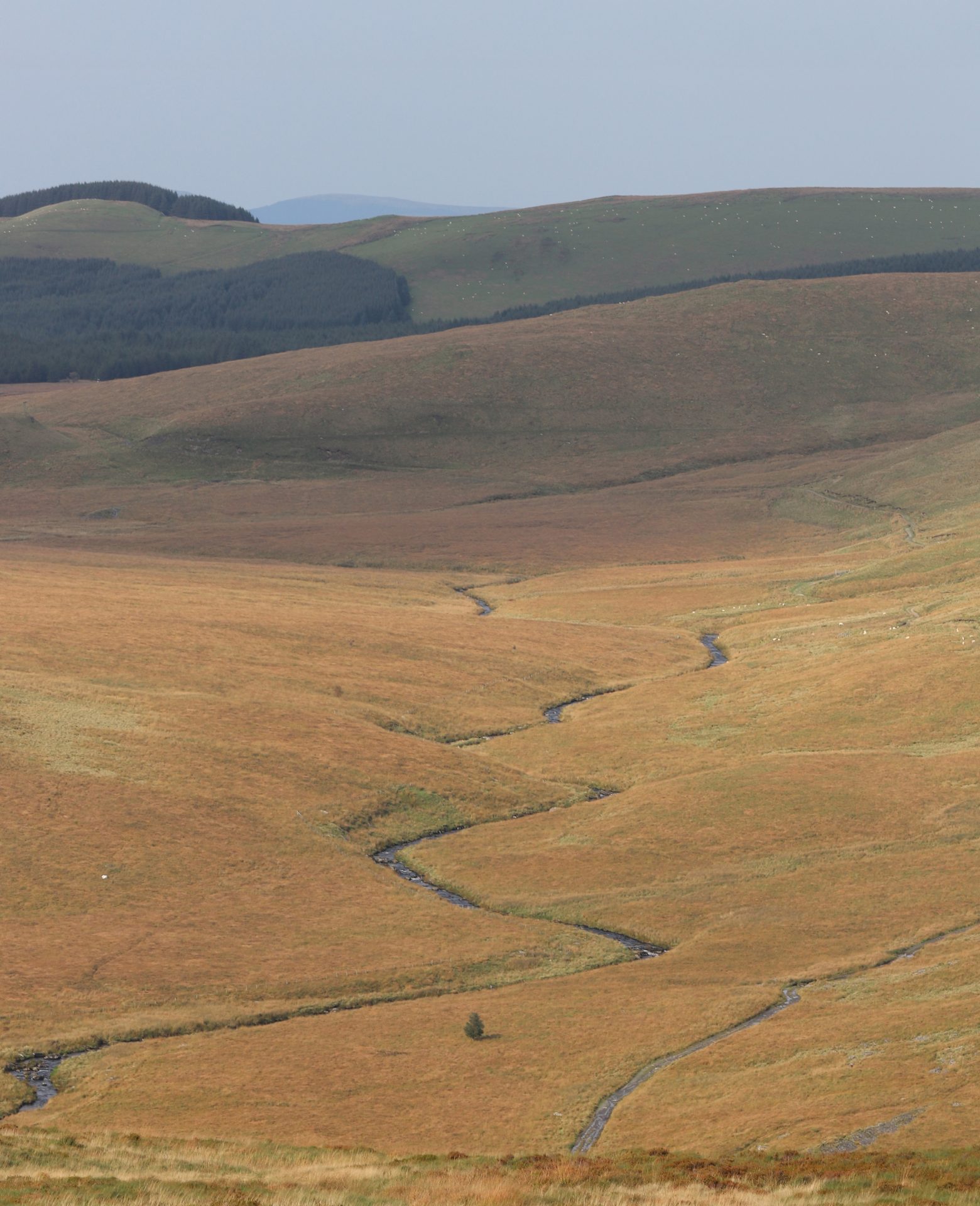
The modern coastline we know and love today – the tidal flats, spits and dunes at Ynyslas, the ribbon of floodplain between Machynlleth and the coast, the low-lying saltmarshes, and Cors Fochno – is the result of dramatic changes that have taken place over the last 11,700 years.
These same long-term processes (sea level changes, peat growth, river and and sedimentation) also created the area’s present-day vulnerability to flooding. They determine which options for reducing the risk of flooding are right for our community, now and in the years to come.
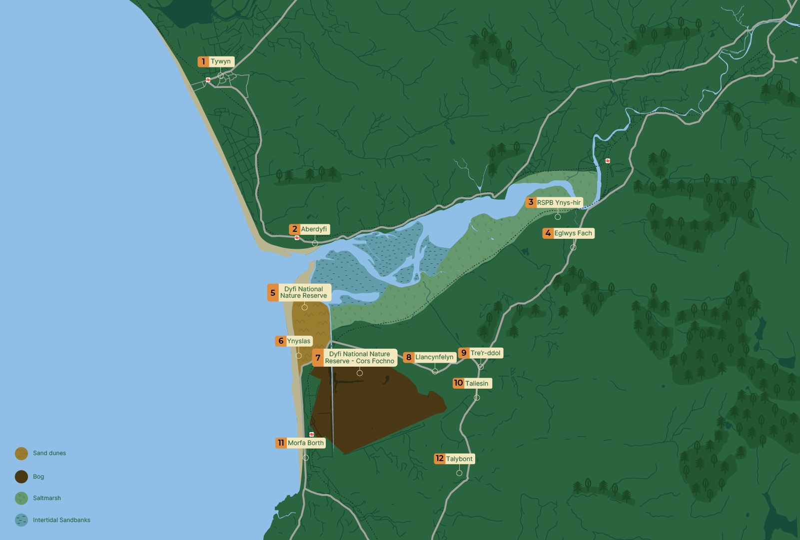
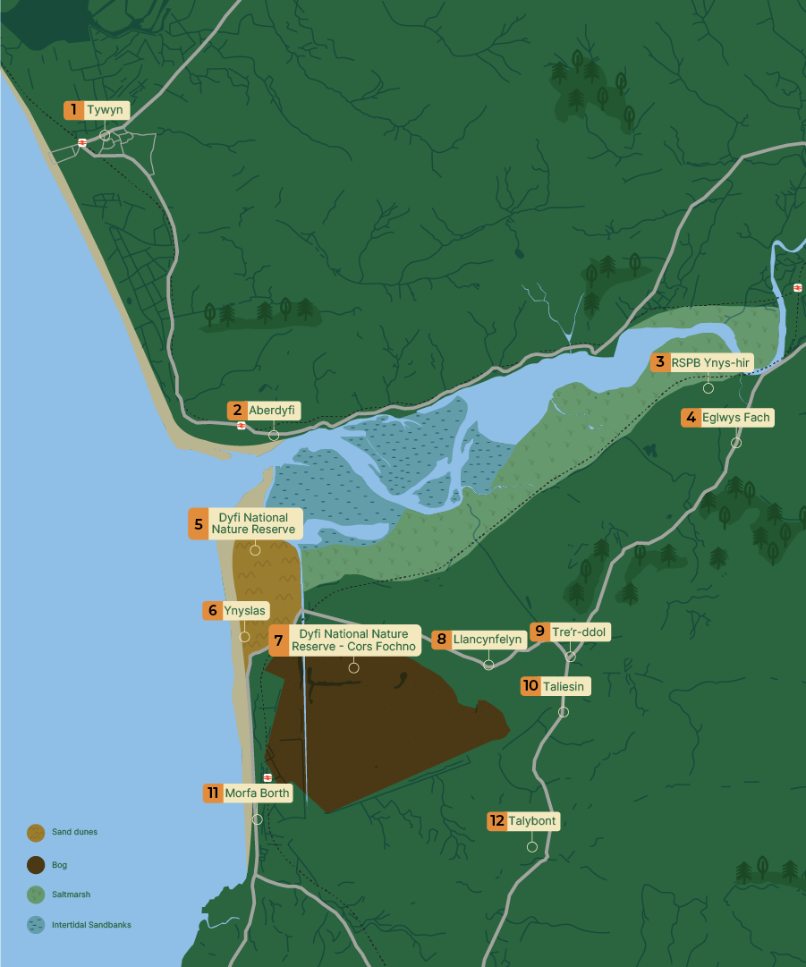
The map shows the Dyfi estuary on the west coast of Wales, opening into the to the west.
The following locations are labelled:
Tywyn (north), Aberdyfi at the estuary mouth, Dyfi National Nature Reserve, Ynyslas, Morfa Borth, Taliesin, Tre’r-ddol, Llandfelyn, Tal-y-bont, Eglwys Fach and RSPB Ynys-hir.
Habitats are colour-coded as follows:
- Twyni tywod (sand dunes) – shown in yellow at Ynyslas, south of the estuary mouth
- Cors (peat bog) – shown in dark brown inland near Morfa Borth
- Morfa heli () – shown in light green along the southern edge of the estuary
- Banciau tywod rhynglanwol ( sandbanks) – shown in blue within the estuary basin
The estuary contains branching tidal channels surrounded by sandbanks.
Back to the start
During the Late epoch, around 27,500 to 23,300 years ago, the landscape of mid-Wales was shaped by two things:
Glaciers that covered most of Wales and the Irish Sea. Meltwater and rising sea level released by glaciers and ice sheets as the climate warmed.
In the Dyfi , thick layers of sand and gravel from and melting ice were deposited on valley floors. They formed a series of raised flat benches (or river terraces) that now sit up to 25 metres above the modern floodplain.
These deposits became the foundation for the rivers to carve out their channels and floodplains.
Ancient river paths preserved on the surface of these terraces show that the Dyfi and neighbouring rivers adjusted their courses repeatedly as , sediment supply and base level fluctuated.
Early-to-mid : Sea levels rise and an estuary forms
As ice sheets and, later, valley retreated from the coast of Wales, the global sea level rose rapidly during the early (11,700 to 8,200 years ago).
The now-submerged offshore Dyfivalley was progressively invaded by the sea. By the mid- (8,200 to 4,200 years ago), it had changed from a river (fluvial) state to an estuary (mixed salt/fresh water). It then transitioned to tidal flats and (or wetlands). The shingle spit at Borth–Ynyslas partially closed the mouth of the estuary and helped create the conditions for the development of Cors Fochno, the raised peat bog immediately inland.
Our modern coastline was broadly established around 6,000 years ago, but growth, spit migration and dune movement remain active.
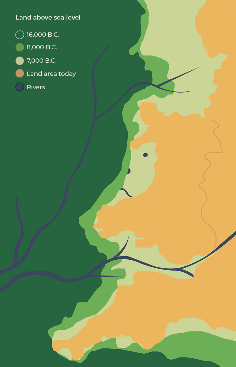
The image is a stylised map illustrating changes in land above sea level over time.
The legend indicates the following:
- Dark green represents land above sea level at 16,000 BC
- Mid green represents land above sea level at 8,000 BC
- Pale green represents land above sea level at 7,000 BC
- Orange represents land area today
- Dark blue lines represent rivers
The map shows that at 16,000 BC the land area was significantly larger, extending further west. By 8,000 BC and 7,000 BC the land mass had reduced in size as sea levels rose. The present-day coastline, shown in orange, represents the smallest extent of land compared with earlier periods.
Multiple rivers are shown flowing across the land, some extending beyond the present-day coastline, indicating river systems that existed before sea levels rose.
The visual demonstrates the gradual reduction of land area over time due to rising sea levels.
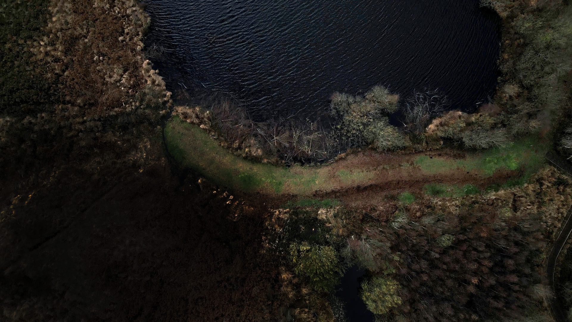
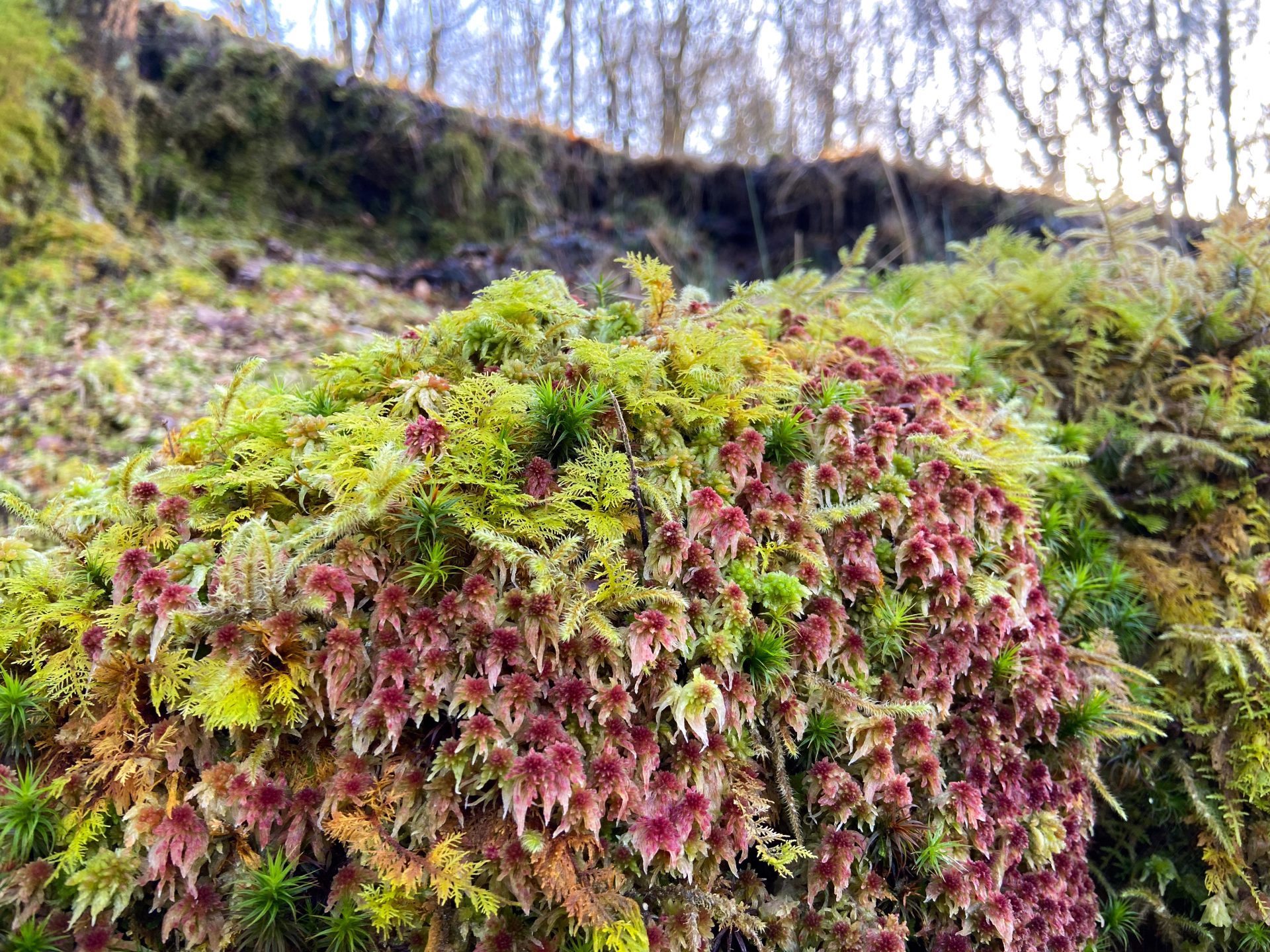
Cors Fochno: An archaeological archive
Cors Fochno is a 650-hectare rain-fed peat bog. It is one of the best-preserved in Britain and contains a high-resolution record of the epoch.
The bog is composed of peat moss, with its central dome reaching a thickness of 5 metres. It started to form on top of an earlier mid forest bed and developed into a rainfed bog about 4,700 to 7,000 years ago.
The layered structure of the bog records past changes in and woodland clearance, as well as when storms took place.
This record has recently been used to track how intense and frequent storms have been in Cardigan Bay over the last 4,500 years.
The bog not only records environmental change, but its peat and drainage system help control local flooding by storing water and reducing the impacts of storm surges.
Cors Fochno also has a rich archaeological record. Key discoveries include a Bronze Age wooden object, evidence of Iron Age/Roman industrial and metal smelting activities, and a medieval trackway
Enclosing a bog and constructing a railway
Cors Fochno
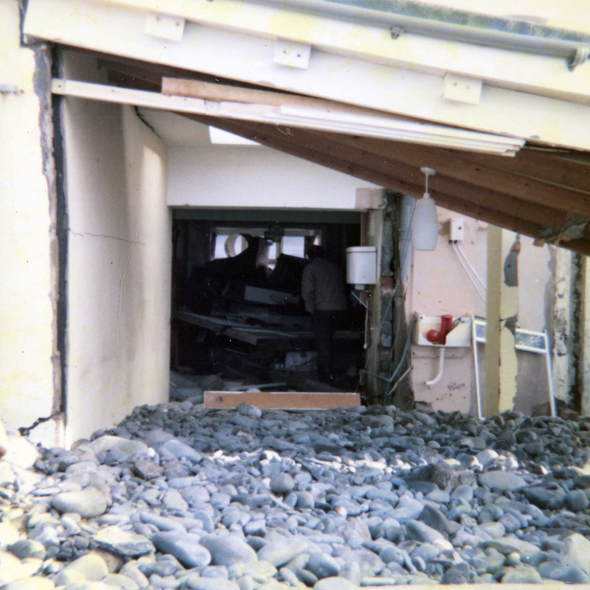
One of the most significant interventions was the enclosure of Cors Fochno between 1813 and 1847. These works also included diverting the Afon Leri directly into the Dyfi Estuary and constructed an embankment along its southern edge.
The embankment reduced the area available to store water below mean high water springs (average highest level that spring tides reach) by 35 percent.
Welsh Coast Railway
The Welsh Coast Railway, built in the early 1860s, has raised tracks that created a barrier which cut off much of the Dyfi’s floodplain from its main channel – especially within the tidally influenced reach of the river and estuary.

What happened as a result?
These schemes significantly changed the morphology and dynamics of the Dyfi Estuary and lower reaches of the river by:
- reducing water and sediment storage
- preventing sedimentation behind embankments
- delivering more sediment from the Afon Leri, now diverted into the Dyfi Estuary
- funnelling the flood tide further up the estuary.
One of the most obvious results of this intervention is one you can still see today – the land behind the old embankments built between Pennal and Gogarth is 1 metre lower than the land outside them, because it hasn’t had any new layers of sediment deposited on its surface for about 200 years.
The rate the Dyfi Estuary is building up sediment is lower than at any time in the last 1,000 years (see figures 1 and 2). These reflect the increase in woodland, a sharp decrease in farming and, most importantly, the closure of waste-producing metal mines in the , all of which have reduced sediment supply to the estuary.
These changes have greatly improved the area’s biodiversity and ecosystem health. But the reduction in sediment supply could, in the long term, see the lower Dyfi start to erode its own bed. While this may locally reduce flooding, it may also mean that less sediment is delivered to the coast to replenish the beaches, which protects the land from the sea.

Mining for metal
Historical metal mining has had a major impact on sediment supply, sediment quality and sedimentation rates of the Dyfi – particularly in the tidally influenced reach of the Afon Dyfi.
The Dyfi , like much of Mid Wales, contains numerous mineral veins (distinct, sheet-like body of crystallised minerals within rock). These veins, rich in lead, zinc, copper and silver, were worked periodically from Roman times through to the 19th century.
Mining reached its peak during the 18th and 19th centuries, when large volumes of ore were extracted and the resultant waste entered the river network. This resulted in widespread contamination that still continues to pollute the Afon Dyfi and many of its tributaries today – made worse by more frequent and severe flooding.

Keeping contaminants at bay
Historical mining places several constraints on flood and management. Floodplain reworking or engineering projects that change the course of the river may disturb contaminated , risking the release of metals into the environment. And this can harm the Dyfi Estuary’s ecosystem and potentially enter food chains.
Ways to help prevent this include:
- Before any major works take place, an environmental assessment must be conducted to evaluate the contaminant levels.
- Stabilising or cleaning up existing waste material can reduce the flow of heavy metals carried by sediment.
- Natural flood management schemes that increase local vegetation cover and slow runoff can reduce (the highest point of a flood). They can also trap contaminants before they reach main rivers.
Protecting people, property and nature
From the medieval period through to the present day, a variety of measures have been taken to reduce flooding, and to protect people, property and nature in the Dyfi – particularly in Dyfi Estuary and in the tidally influenced reach of the river upstream to Machynlleth.
Embankments and land drainage were constructed on both sides of the river between Pennal and Gogarth to protect land from flooding, and also around the margins of Cors Fochno.
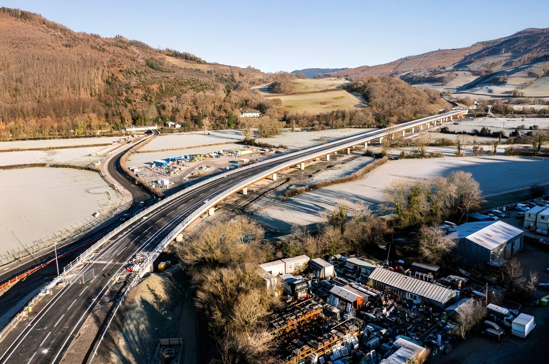
One of the biggest measures has been the new Dyfi Bridge, near Machynlleth. Opened in February 2024, at a cost of £46m, it was built to improve the A487 trunk road and provide a more resilient route, especially during floods.
All of these structures can protect infrastructure locally. But they can also change where water flows during high river flows and storm surges – sometimes concentrating risk downstream or in places with fewer natural buffers.
Recent modelling for the Dyfi emphasises the interaction between engineered measures and natural systems, and the need to plan with space for water.
We’re also now doing more work to preserve key species along the estuary, with recognition of the important nature reserves including Pen Llŷn a’r Sarnau Special Area of Conservation (PLAS SAC), Dyfi Biosphere and the Dyfi National Nature Reserve.
In the future, we will have to decide how we manage land for nature, knowing that with there will be winners and losers among the species living within the estuary.
Chapter Three:Climate change impacts
Over the next 50 years, will be driven mainly by human-caused greenhouse gas emissions. Emissions trap heat and water vapour in the atmosphere, leading to warmer temperatures, rising seas and more extreme weather.

Even if emissions slow, the Earth will keep warming because of the gases already in the air. The result? Bigger storms, larger and more frequent floods, hotter summers and shifting coastlines.
The Dyfi Estuary and are likely to face compounding climate-related pressures, including:
- rising sea levels
- higher extreme sea levels during storms
- more intense winter (and possibly summer) rainfall, and runoff
- more frequent and severe river floods
- warmer, drier summers
These will reshape the Estuary and the area’s rivers, the supply and loss of sediment, habitats (, dunes, bog), river dynamics and flood risk to people.
But there is a lot that flood and managers, policymakers and practitioners can do to help people living and working in the Dyfi Estuary and adapt to these changes – see chapter 9 to learn more.
Predicted , estuary and river changes
Sea level rises and higher storm levels
UK projections show significant increases in mean sea level (gradual increase in the average height of the sea surface) and extreme sea levels (events where the highest water levels occur) when storm surges and tides coincide.
According to the UK Climate Projections (UKCP18), sea levels are expected to rise significantly by 2075.
These increases will make it much more likely that low barriers and dunes are breached. The estimated mean sea level rise expected for Ceredigion is 0.8 to 1.07 metres according to Welsh Government predictions.
More intense winter rainfall and higher river flows
Observations and model projections show increases in extreme winter rainfall events, which drive higher river peaks (when the river is at its highest) and faster runoff from the uplands. Which means that river floods are getting more frequent and more severe across the .
River flooding combined with high tides/storm surges create compound flooding events that are more damaging than a standalone event. These will result not only in breaches of Borth beach and Ynyslas Dunes, but also large-scale channel bed and bank , and possible relocation (termed ‘an avulsion’) of the Dyfi River to another part of its floodplain.
In the case of the Western Wales River Basin District that includes the Afon Dyfi , model predictions indicate betweena 30% and 70% increase in river flows by the 2080s (compared to the 1960 to 1991 baseline), according to Welsh Government data.
Warmer seas and altered wave patterns
New research shows that marine heat waves are already becoming an issue. During the heat wave of June 2023, temperatures in the UK’s shallow seas reached 2.9 degrees above the June average for 16 days, according to a study carried out by the University of Exeter, the Met Office and Cefas (Centre for Environment, Fisheries and Science).
These warmer waters near the shore, combined with changing storm tracks (the path that storms follow across a particular region), are altering wave energy and water movement in estuaries.
Ecological changes and prolonged periods of unusually warm ocean temperatures will also affect the diverse groups of organisms living on, in or near the bottom of the sea that influence and sediment .
Changes in the ’s water and land condition
Heavily compacted soil, drained peat bogs and fewer trees because of past farming practices cause water levels to rise more quickly.
Targeted land management can slow and sometimes reduce the flow of water and sediment delivery. Recent natural flood management projects in the Dyfi – such as those in the Afon Pennal and Leri (see chapter 9) – show how important and potentially effective these schemes are.
Unfortunately, in Wales, there is no data available for the long-term effectiveness of these schemes for catchments larger than 10 km2 – and especially during extreme flooding or flooding that lasts weeks to months, according to Welsh Government data.
These schemes do, however, appear to be improving local habitats and biodiversity, but do not prevent flooding during extreme storm events
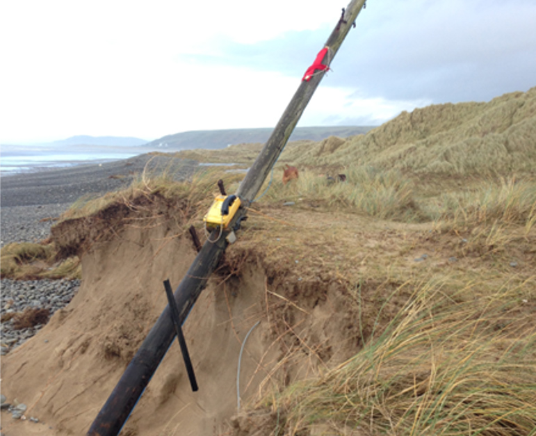
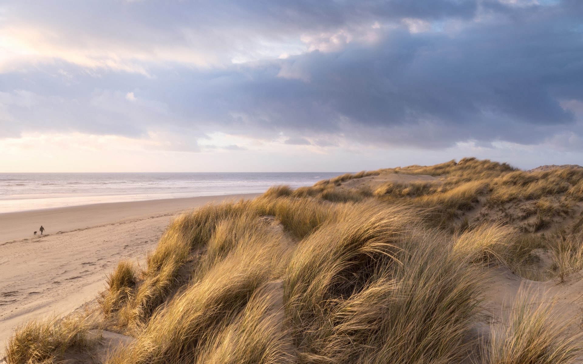
Spit, dune and beach systems will be under stress
Increased overtopping, pounding waves and higher mean water levels will accelerate dune and cause the Ynyslas-Borth spit to migrate or breach more often
In the case of our valley, the erosion or lowering of spits and dunes leaves the estuary mouth and surrounding lowlandsunprotected against strong waves and saltwater flooding.

Damage to
Saltmarshes naturally act to reduce wave energy and trap fine sediment. Rising water levels combined with fixed sea defences or hard infrastructure that prevent inland migration will reduce a marsh’s size, undermining a key natural defence (a phenomenon termed ‘’, where the water is pushed into specific areas and not allowed to spread out).
If a marsh has space and enough sediment, it can grow. But engineered structures may prevent this from happening.
Damage to floodplains and peatland
More intense winter storms and increased water runoff will cause the low-lying floodplain between Machynlleth and the Dyfi Estuary to flood more often.
Wetter winters may re-wet some peat areas, but warmer, drier summers and further drainage could damage them, weakening the peat’s ability to store water while releasing into the atmosphere.
So, restoring peat is both a resilience and climate mitigation action.
Movement of historical mining waste
During the June 2012 Ceredigion floods, mining waste stored in waste tips and floodplains in the Afon Leri, and Afon Ceulan catchments were eroded and transported downstream. As a result, this contaminated, finegrain sediment was deposited on floodplains and in estuarine environments in lower Dyfi valley.
Increased flooding will remobilise contaminated sediment, damage ecosystems and making it difficult to carry out flood control methods, such as digging ponds in floodplains to store floodwater.
More households, infrastructure and services at risk
Even with local embankmentsand defences, increased overtopping and backwater flooding will raise the frequency of property-level flooding, leading to higher insurance costs and disruption to roads (like the A487), the railway, utilities and farm livelihoods.
Contaminated floodwater and sewage overflows pose a risk to public health. Knowing the difference between what is right for communities (such as Borth) and what is right for more inland villages such as Talybont will help to properly control flood risks and reduce the severity of flooding.

But the next 50 years offers an opportunity
will not be a single shock to the Dyfi but a process of intersecting pressures – accelerating sea level rise, differing river and responses, contamination from historical mining and changing ecosystems.
What is essential now is to link science and policy tools to longterm, community-led decision making. We also need to adopt adaptive, incremental responses that favour nature-based defences backed by targeted engineered protection. You can read more about this in chapter 6.
The next 50 years offer an opportunity: by looking after our peatlands, making strategic space for the estuary waters, and supporting communities and landowners to adapt, the Dyfi can become a model of thatprotects people, nature and heritage.
Chapter Four:Species and habitats
Anyone who lives or visits the Dyfi area will know how rich in wildlife it is. The area supports an amazing diversity of habitats, from offshore reef systems and estuarine salt marshes, through Atlantic rainforest woodlands in deep-cut river valleys, to more exposed upland bog habitats and heathland on the mountains surrounding the region.
This impressive array of habitats in turn supports countless species that can be found across the area – many of which are rare and highly restricted.
In this chapter, we explore what some of those species and habitats are. We also look at some of the ways we might expect the dynamic and estuarine environment of the Dyfi to respond to future changes in climate, sea level and extreme weather events.
It outlines some of the challenges to nature conservation and land managers seeking to safeguard the important species and habitats found in the Dyfi. It also highlights some of the ways we can adapt our activities to increase the of this amazing area of Mid Wales to the changes on the horizon


Unique habitats and species found here in the Dyfi:
A key component of the Dyfi region is its river systems, estuary habitats and marine environment.
The dynamic connection between land and sea has dictated the region’s human and ecological communities for millennia and is of foremost importance as we look to the coming years.
It is at this intersection that we find some of the area’s most important and unique habitats and species: one of Wales’s largest lowland-raised peat bogs is located between Borth and Taliesin (Cors Fochno) which is home to rare species like the large heath butterfly, rosy marsh moth and bog bush-cricket. The large heath butterfly is a rare butterfly with only a handful of strongholds left in Wales. In the Dyfi, a population found on Cors Fochno represents the very southern edge of this butterfly’s UK distribution.
Extensive salt marsh and mud flat habitats straddle the river sides between Ynys Las and Pennal, and are of immense importance for overwintering wading and wildfowl bird species like curlews, oystercatchers and wigeon.
The sand dune habitats of Ynyslas host an immense diversity of rare plant species such as early marsh orchids and bee orchids, as well as sand lizards reintroduced in 2009. This habitat is also home to the irish lady’s-tresses: a beautiful and dainty little orchid, this scarce plant was only discovered in the Dyfi in 2019 and is the only known site in Wales. It exists in the Ynyslas dune systems and flowers from July to August.


Rocky outcrops jutting out from the farmland, wetlands and salt marsh habitats of the estuary support old, mature oak woodlands where migratory birds such as pied flycatchers, wood warblers and redstarts breed come spring.
Beyond the shoreline we can find bottlenose dolphins, grey seals and important seasonal feeding grounds for seabirds like manx shearwaters, as well as unique reef systems associated with the immense glacial boulder formations of Sarn y Bwch (near Tywyn) and Sarn Gynfelyn (near Aberystwyth).
Here are a few more of the scarcer birds and animals that can be found here in the Dyfi:

Greenland Whitefronted Goose
The Dyfi Estuary is one of only two places in Wales where these very rare geese spend their winters. Currently, the global population numbers 18,000, and sadly their numbers are declining every year, mainly because of poor breeding success in the Arctic.

Lapwing
The Dyfi has one of Wales’s largest breeding populations and the only viable populationin South and Mid Wales. Once a common farmland bird, it’s now restricted to areas where there is targeted management for this species.

Osprey
The Dyfi is famous for the breeding pair at Cors Dyfi and demonstrates that conservation measures can turn the fate of rare species around. It is also an important economic driver in the area

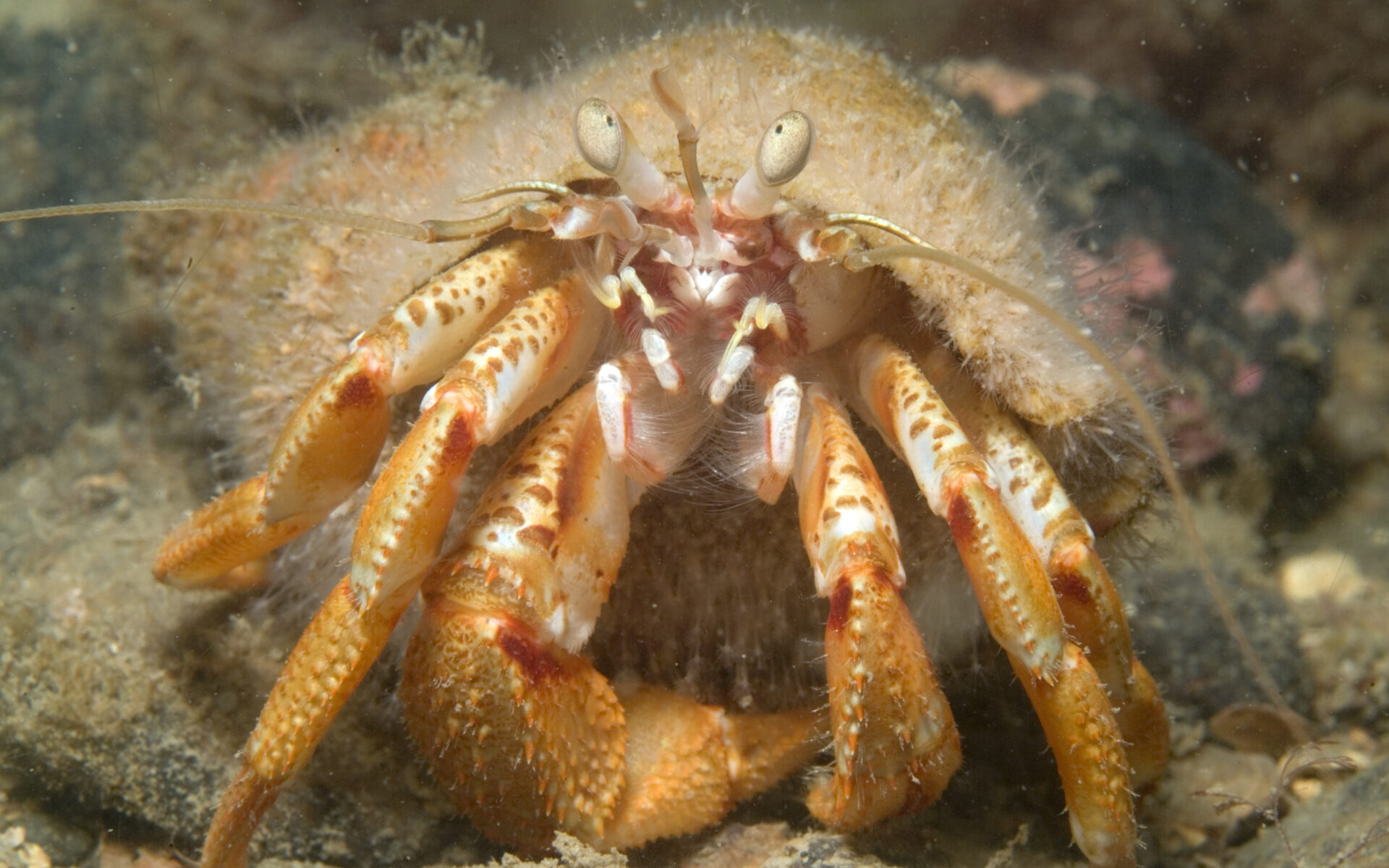
Otter
The Dyfi has a high population of this charismatic mammal around its river, wetland and habitats. It’s a species that requires a healthy aquatic environment with safe places to retreat to.

Salmon and Sewan
The Dyfi is a famous fishery for salmon and Sewan, a type of brown trout that migrates to the sea. Both species have declined dramatically over the years and are important for the Dyfi food chain and local livelihoods.

An area of ecological and cultural importance
The Dyfi’s importance for wildlife and diverse habitats – both on land and at sea – is reflected in the many UK and European designations the area holds.
For example, the entire Dyfi is designated as a UNESCO Biosphere reserve (the only one of its kind in Wales) in recognition of its immense ecological and cultural importance.
The Dyfi Estuary, Ynyslas Dune system and lowland raised bog habitat of Cors Fochno make up a substantial National Nature Reserve, with specific Special Areas of Conservation and RAMSAR wetlands sites found here.
Further afield
Further afield in the upland regions are many Sites of Special Scientific Interest (SSSI), including the immense upland plateau of Pumlumon – with its upland birdlife and vegetation assemblages.
The coastline and marine region of the Dyfi is part of a much wider marine Special Area of Conservation (SAC) which extends from the reef systems off Aberystwyth all the way up the coast of Pen Llŷn in the north – the Pen Llŷn a’r Sarnau Special Area of Conservation (PLAS SAC).
This designation not only recognises the species of importance occurring offshore but also highlights the complex array of habitats that exist from shore to sea: from the sheltered waters of the estuary, with its mudflats, saltmarshes and tidal channels, to more exposed rocky shorelines with habitats and seaweed communities, to the sandbanks and reef systems offshore.
The Dyfi estuary is a UNESCO biosphere and part of a national nature reserve which incorporates Cors Fochno, Ynyslas sand dunes, the RSPB Ynys-hir Nature reserve and the Dyfi Osprey Project. Taken together, such designations provide an important framework for guiding the conservation, land use and marine activities in the area, as well as providing funding opportunities for restoration work and nature-positive activities
The challenge of
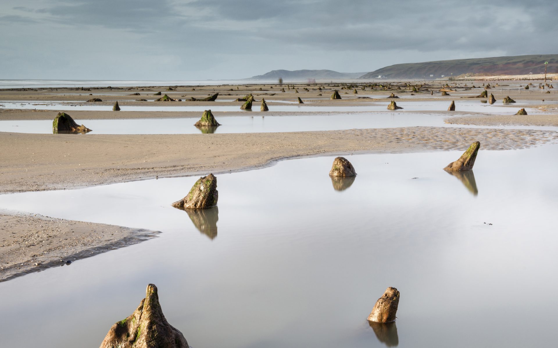
As described in chapter two, the Dyfi area has changed over time, and it will continue to change in the years to come. The ‘petrified’ forest on the beach of Borth and Ynyslas is testament to the fact that ecosystems in the Dyfi have been very different indeed in the past: where the coastline now exists, it once supported an immense forest whose stumps are now glimpsed at low tide, preserved in peat below the waters.
Change is a constant in the natural world, yet the rapidity of the current human-induced is exceptional. Species and habitats are much less able to adapt to the rate of current change – but there are ways we can help wildlife to weather the changes and work hand-in-hand with the natural world to help ourselves cope with the changes too
In the Dyfi region, the impacts of to the landscape and its ecology include the increasing severity and frequency of storm events, flooding and drought, wildfires, sea level rise and changes in the species that are able to exist here. The estuary and its surrounding grasslands, bogs, marshes and woodlands are particularly vulnerable to the combination of sea level rise and increasing storm events. This is especially so because of a number of alterations that humans have engineered in the landscape.
Before human influence, the estuary would have been a highly dynamic and everchanging environment: habitats like salt marsh (a mix of salty and fresh water) gave way to peat bogs and woodlands, and the interaction between these habitats would have waxed and waned over time according to the sea level. Humans interrupted this natural cycle by erecting flood defences, digging drainage channels and constructing the current railway line. The result of these structures has created an artificial divide between the saline estuary, freshwater bog and agricultural land.
Over time, wildlife has adapted to these changes. For example, the low-lying land at Ynys-hir, known as lowland wet grassland, was once bog but is now agricultural grassland. It supports Wales’s most important breeding wader population, with large number of lapwings, redshank and snipe, and rare Greenland White-fronted geese rely on this lowland wet grassland for much of the winter. Climate-induced sea level rises and increasing storm events now threaten the habitats that have been created in these areas. Flood events can result in water spilling out onto agricultural fields and lowland wet grasslands. This can kill soil invertebrates, which are a vital food source for the wading birds that now rely on these habitats. The standing water also damages and degrades agricultural land. Recovery times are slow and it may be months, or even years, before the populations of invertebrates recover.
The challenge that land managers, including conservationists, around the Dyfi Estuary face is how to adapt to these changes to safeguard nature, while accepting that some habitats and species might be lost.
We must also look at the Dyfi area as a whole and balance the needs of nature against other priorities around us, such as preventing property and infrastructure flooding, and the effect on livelihoods as traditional land uses become more challenging.
There may be situations where nature can give us a helping hand too.
When an ecosystem becomes unbalanced, or is placed under increasing pressure from , can offer a sustainable and effective response. As the name suggests, these approaches use natural species, habitats, and processes to restore and strengthen environments and the systems that depend on them.
In many cases, the species or natural structures being supported or reintroduced would historically have existed within the ecosystem. Over time, however, they may have been lost or degraded due to factors such as hunting, human development, pollution, or the introduction of invasive species. therefore often involve reinstating natural processes or key species that once helped regulate and balance the system
can offer a more enduring alternative to expensive, civil engineered structures designed for the same purpose. For example, concrete walls or earthfilled embankments for flood defence have a finite life and represent a thin, fixed line. Once breached, water can inundate a large area of land behind them, presenting a very sudden and dramatic change.
There are certain natural habitats that can dissipate the energy of floodwaters and serve to absorb water during these events. Salt marsh habitats form a broad swathe of vegetation composed of a variety of plants that tolerate the nature of estuarine water. They typically form on estuarine above the low tide line and are situated on the raised, level platforms adjacent to muddy creeks, and above mud and sand flats
Salt marsh acts as a protective barrier around much of the Dyfi Estuary. However, it is threatened because rising sea levels will submerge the marsh’s lower fringe (or edge) permanently, leading to significant loss. Currently, there are few areas where salt marsh can form further up the fringes of the high tide line due to fixed features – such as the railway embankment – preventing much of the tidal water flowing further inland. There may be some areas where an intentional breach of this structure could occur – provided the railway is safeguarded and key areas of productive farmland are avoided. A breach in some key areas could allow for new areas of salt marsh to establish, restoring the natural protective border of vegetation.

Helping to slow a river’s flow
Further from the shore, there are range of ‘soft’ nature-based approaches that can help in our effort to buffer the effects of climate-induced changes. To address major flooding events, we can look upstream to the wider and seek to slow the flow of flood waters reaching the estuary via its tributaries and rivers. Slowing the flow of rivers during periods of intense rain and storm events can involve a whole range of holistic actions: regenerative land management practices help to increase soil health, and healthy soils are much more able to absorb water – resulting in less runoff reaching rivers in the first place. We can look at areas where buffers strips of trees can be planted close to water courses, which further reduce runoff into rivers. ‘Leaky dams’ can be constructed with piles of tree branches and trunks, forming leaky barriers that slow the flow of water.
There are already a number of inspiring projects locally using such methods to address flooding events: in the Tal y Bont region, a community group have been working with local landowners and farmers to construct leaky dams, as well as planting hundreds of hedges and thousands of trees in the surrounding catchments to help
reduce the possibility of future flooding. In the Pennal region of the Dyfi Estuary, a large group of landowners and farmers have come together to create the ‘Pennal 2050’ partnership: this seeks to use natural flood management techniques to address flooding risk in the area. The project has installed a raft of leaky dams in the , has improved soil health on a large area of farmland, and has planted woodlands, hedges and strips of trees to further combat the risks of flooding.
Another nature-based solution is ‘re wiggling’ rivers. Historically, land reclamation projects involved excavating new water courses and straightening existing rivers – an example of this is the lower stretch of the Afon Leri, close to the lowland raised bog of Cors Fochno. Restoring the river’s meanders makes the river more than three times longer between two fixed points. This increase in length allows the energy of floodwaters to be absorbed at each bend, slowing the water and easing the intensity of some flooding events.

A careful balancing act
Over time, our flood defences have deteriorated and the cost of upgrading them to meet future sea level rises and resist storms is extremely high. Although we want to conserve the species living here in the Dyfi, there is also an understanding that we will have to adapt to new pressures affecting the area.
Implementing changes and adaptations in a controlled way may allow for the creation of new habitats in the Dyfi, and with them we might welcome new species whose distributions are changing further afield. For example, is forcing birds usually found in Europe to move northward, such as the great egret, spoonbill, avocet and black-winged stilt. Ensuring sufficient, diverse habitats exist across the Dyfi will be important to ensure that such species can find a new home once displaced from their existing breeding regions further south.
Conclusion
The Dyfi Estuary faces significant challenges from in the coming decades, impacting both its natural habitats and the species that rely on them. As we confront rising seas, intensified storms, and shifting ecosystems, it is essential to embrace solutions that not only protect biodiversity but also enhance the of the local community – these can include that work hand in hand with nature, but must be informed by careful dialogue with those living and working in this special area of Wales. A careful balance must be struck between conservation efforts and the economic needs of the area, fostering collaboration among land managers, conservationists, and the public. By prioritizing adaptive management strategies, we can create a sustainable future where both the environment and local livelihoods thrive, ensuring that the Dyfi Estuary continues to be a sanctuary for wildlife while remaining a vital part of our community.
Chapter Five:Coastal adaptation
is the process of adjusting to current or projected sea level rise, and other impacts of to build in communities and environments.
Part of this process involves the creation of Shoreline Management Plans. They provide a strategic, long‑term framework for managing risks from flooding and .
They assess how different stretches of coastline are likely to change and set out preferred management approaches – such as holding the line, , or no active intervention – over 20, 50 and 100‐year horizons.
Their purpose is to balance environmental, social and economic considerations so that communities, infrastructure and habitats can be protected in a sustainable and coordinated way.
Adaptation strategies for managing the coastline
The four main adaptation strategies used in shoreline management plans are:
- holding the line
- advancing the line
- no active intervention
These strategies are all based on scientific, social, economic and environmental data.

Hold the line
‘Holding the line’ is a phrase used in management to describe a way of keeping the coastline in its current position and preventing the sea from encroaching where it’s not wanted.
On vulnerable stretches of coastline where holding the line is important, it’s critical to understand how dynamics (how the currents, wave patterns, wind, tides and shifting sediment shape our coastline) and how different defence options will respond to the physical conditions.
Before deciding what defences to build, engineers study and model dynamics. They also look at how different defences will behave and try to predict how they will affect the natural processes along the coast (the ). This is important because choosing the wrong defence option can change the dynamics and work against holding the line.
The hold the line strategy has been used in Borth’s current sea defences. The new defences include giant rock boulders and rock groynes, and fish tail shaped breakwaters, along with a reef, which also improves surf conditions.
Advance the line
This is where new defences are built further into the sea, extending existing defences and reclaiming land in the process.
, is where the shoreline is moved backwards, with management to control or limit the movement of water from the sea. If an area is at high risk of , could be an option.
often involves the controlled flooding of low-lying areas to relieve the effect. In the Dyfi, this would require careful discussion and collaboration with any landowners and homeowners who have low-lying land or property.
In some cases, , combined with marine habitat creation, may be needed to compensate for the environmental cost of holding the line (where Marine Protected Areas are affected by ).
Although typically applies to low-lying areas at risk of flooding, it can equally be applied to cliff areas to help reduce the rate of recession for a period of time.
There are also some costs involved with . Some defences will need to be removed or redesigned, and land and property owners may need to be financially compensated.
But this strategy costs less compared to paying for new sea defences. It also creates a salt marsh, which can support many species and acts a natural defence against and flooding.
However, through this strategy, land is reclaimed or changed by the sea. This will impact livelihoods, people’s homes and the history and culture associated with the land
What is ?
is the loss or deterioration of natural shoreline habitats – such as beaches and salt marshes – that stems from being trapped between man-made defences and rising sea levels. This prevents the coast from moving inland as it normally would.
No active intervention
This is the ‘do nothing’ strategy – so there is no investment in installing or maintaining any defences. Where there are no existing defences, the shoreline will continue to evolve naturally.
There are areas that currently have sea defences that could be left to evolve more naturally by not repairing them when they break down, which may include an increased risk of flooding or . Alternatively, the old defences might be removed to implement a ‘do nothing’ strategy.
Natural Resources Wales is working on the next iteration of the shoreline management plans to create the Borth to Ynys-hir Strategy, as described in Chapter 6.
How other communities are building
A good example of other communities building in Wales is the Pembrokeshire Forum (PCF), who have created a Climate Adaptation Toolkit for the county. The toolkit has been officially endorsed as a United Nations Ocean Decade Activity, recognising the project’s contribution to international efforts to build a more sustainable relationship with the world’s oceans
Recent breaches of man-made flood defences
- 1990: Properties flooded due to breach of Afon Ddu
- 1997: Major breach of Afon Leri
- 2001: Breach of flood defences
- 2007: Breach of Afon Ddu’s right bank
- 2012: Overtopping after extensive river flooding; tens of properties and caravans affected
- 2014: overtopping; several properties and gardens affected
- 2016: overtopping; properties affected
- 2017-18: overtopping and damage to defences
- 2019: Several breaches of Afon Leri embankments
- March 2020: Breach of the east Afon Leri; emergency repair needed
- August 2020: One of the repaired defences fails
- 2021: Localised flooding due to embankment damage
- 2022: Breach of the timber south of the Dyfi Dunes; damage and flooding
Chapter Six:Welsh marine & coastal policy
Policies are formal documents and guidelines that are implemented by organisations. They ensure consistency and effective decision-making. When we refer to Welsh marine policy, we can look at Welsh Government responsibilities and the responsibilities of Natural Resources Wales, but also at local authorities and their role in implementing and following policy.
Government policies can have a serious impact on our lives. It’s important to understand where the different responsibilities lie to know how we can effect change. It can often feel that different institutions put accountability and responsibility back on to other government bodies or institutions. By understanding which regulating body has legal responsibility we are better able to ask for support and to hold them to account.
This chapter lays out important policies relating to Wales and the coast, and flood management.
Please note that policies are always changing. We will do our best to update this chapter, but it’s most accurate as of January 2026
Who’s responsible for flood prevention and the coastline in Wales?
Responsibility is jointly held amongst several bodies:
Welsh Government
The Welsh Government sets strategic direction and objectives for flood risk management and prioritise flood risk management funding. It also sets the policy for .
It acts as a Risk Management Authority in its duties as the highway authority for motorways and trunk roads. Risk management Authorities are organisations that have a statutory responsibility for managing flood and risk.
The Welsh Government is also responsible for marine planning and licensing and marine biodiversity policy, and the national strategies for decarbonisation and climate adaptation.

Natural Resources Wales
{PLACEHOLDER: LOGO}
Natural Resources Wales provides general supervision and communication of flood risk management in Wales. It’s responsible for managing flood risk from main rivers, reservoirs and the sea. It also has a wider oversight role for all flood and risk management in Wales.
Natural Resources Wales has a broad statutory role focused on the sustainable management, protection and enhancement of Wales’ environment and natural resources.
Natural Resources Wales’s duties in relation to flood risk include:
- Reporting to the Minister on flood and risk in Wales, including the application of the National Strategy
- Acting as an advisor, consultee and regulator
- Acting as Wales’ largest land manager
- Designating protected areas
- Forecasting, warning and informing on potential and actual flooding from all sources of flooding in collaboration with Met
Office partners - Designating certain structures or features that affect flood or
risk - Flood risk mapping
- Flood defence maintenance
- adaptation (including the
Adaptation Plan 2023-2027) - Emergency response coordination
It also must pursue and apply the principles of sustainable management of natural resources, as required under the Environment (Wales) Act 2016
Local authorities as Lead Local Flood Authorities and Highway Authorities
The Lead Local Flood Authority (LLFA), which for the Borth to Ynys-hir region is Ceredigion County Council, has responsibilities and powers to manage flooding from local sources which include ordinary water courses (natural or artificial channels through which water flows, including streams, ditches, drains, and culverts, but don’t include main rivers), surface water and groundwater. It also manages highway drainage (excluding trunk roads) as the Highway Authority.
The duties Ceredigion County Council must carry out include:
- Preparing a Local Flood Risk Management Strategy
- Complying with the National Strategy
- Co-operate with other authorities
- Investigating all flooding within the area
- Maintaining a list of structures and features that could affect flood risks
In addition, Ceredigion County Council has permissive powers – this means there’s no duty to act, but it can carry these things out if they choose to.
This includes the powers to:
- Request flooding and drainage information
- Designate certain structures that affect flood/ risk
- Carry out works to include broader risk management actions
The Council also has the ability to cause flooding or under certain conditions.
You can find out more about local flood risk management on the Ceredigion County Council website.
Further up the Estuary, there are different lead local authorities for Gwynedd and Powys where the principals and responsibilities.
Policies, plans and strategies at work in Wales
All of these rules and regulations serve to help protect the sea, coastline and communities throughout Wales
The Well-being of Future Generations Act 2015
The Well-being of Future Generations Act (Wales) 2015 mandates five ways of working for public bodies to consider long-term impacts, collaborate and encourage participation in decision making to address issues like poverty and . One example of how these ways of working are being embedded into delivery is Y Môr a Ni (The Sea and Us), the ocean literacy (an initiative aimed at enhancing the relationship between people and the ocean) framework for Wales.
Y Môr a Ni is the UK’s first national ocean literacy strategy. It aims to build an understanding of how people, communities and businesses across Wales connect with Welsh coasts and seas. It also seeks to determine the impact of our individual and collective actions on the ocean’s health – and its impacts on us – so we can improve how we manage and use our coasts and seas.
Environment (Wales) Act 2016
The Environment (Wales) Act 2016 establishes the legal framework for the Sustainable Management of Natural Resources (SMNR) in Wales. SMNR is the core purpose of Natural Resources Wales and a key component of a joined-up approach to improving the wellbeing of the nation for current and future generations.
The objective is to maintain and enhance the of ecosystems and the benefits they provide. It’s also about meeting people’s needs today without compromising the ability of future generations to meet their needs.
The Well-being of Future Generations Act 2015 and part 1 of the Environment (Wales) Act 2016 work together to support seven wellbeing goals:
- A globally responsible Wales
- A prosperous Wales
- A resilient Wales
- A healthier Wales
- A more equal Wales
- A Wales of cohesive communities
- A Wales of vibrant culture and thriving Welsh language
Flood and Water Management Act 2010
According to GOV.UK, The Flood and Water Management Act 2010 ‘provides for better, more comprehensive management of flood risk for people, homes and businesses, helps safeguard community groups from unaffordable rises in surface water drainage charges, and protects water supplies to the consumer’.
The Act also defines flood risk management authorities as ‘organisations that have a statutory responsibility for managing flood and risk’.
In Ceredigion, these are:
- Ceredigion County Council (as the Lead Local Flood Authority)
- Natural Resources Wales
- Dŵr Cymru Welsh Water
- Ceredigion County Council (as the Highway Authority)
- North and Mid Wales Trunk Road Agent
Borth to Ynys-hir Plan
Natural Resources Wales and Ceredigion County Council are currently working on the Borth to Ynys-hir plan.
The objectives of the plan are to:
- Protect communities from flooding
- Work with the community
- Support a thriving local economy
- Make the best use of public money
- Plan for the future
- Support the of nature and the environment
The aim is to create an adaptive management plan which will provide a roadmap for actions to maximise flood protection of communities at risk while managing adaptation to the rising sea over the next 100 years.
Key stakeholders include Network Rail; Scottish Power; Welsh Parliament; Welsh Government; Ceredigion County Council; Transport for Wales; Borth Community Council; Borth 2030; Aberystwyth University; Farmers’ Union of Wales; RSPB; Tir Canol; Natura 2000; and the EU’s LIFE programme.

Welsh National Marine Plan
Marine planning and licensing support the sustainable development of our seas, as set out in the Marine and Access Act (2009).
The Welsh National Marine Plan sets out policies to guide the use of our seas.
The Welsh National Marine Plan’s policies cover topics such as:
- Nature conservation
- Water quality
- Seascapes
- communities and economic growth
- Heritage
- to change and flooding
Its policies cover all types of activities, from dredging and (sand, gravel and crushed rock that have been dredged from the seabed) to energy generation (renewable and non-renewable), ports, shipping and tourism and recreation.
The Welsh Marine Protected Area Network
The Welsh Marine Protected Area Network covers approximately 69% of the Welsh inshore area (up to 12 nautical miles) and includes:
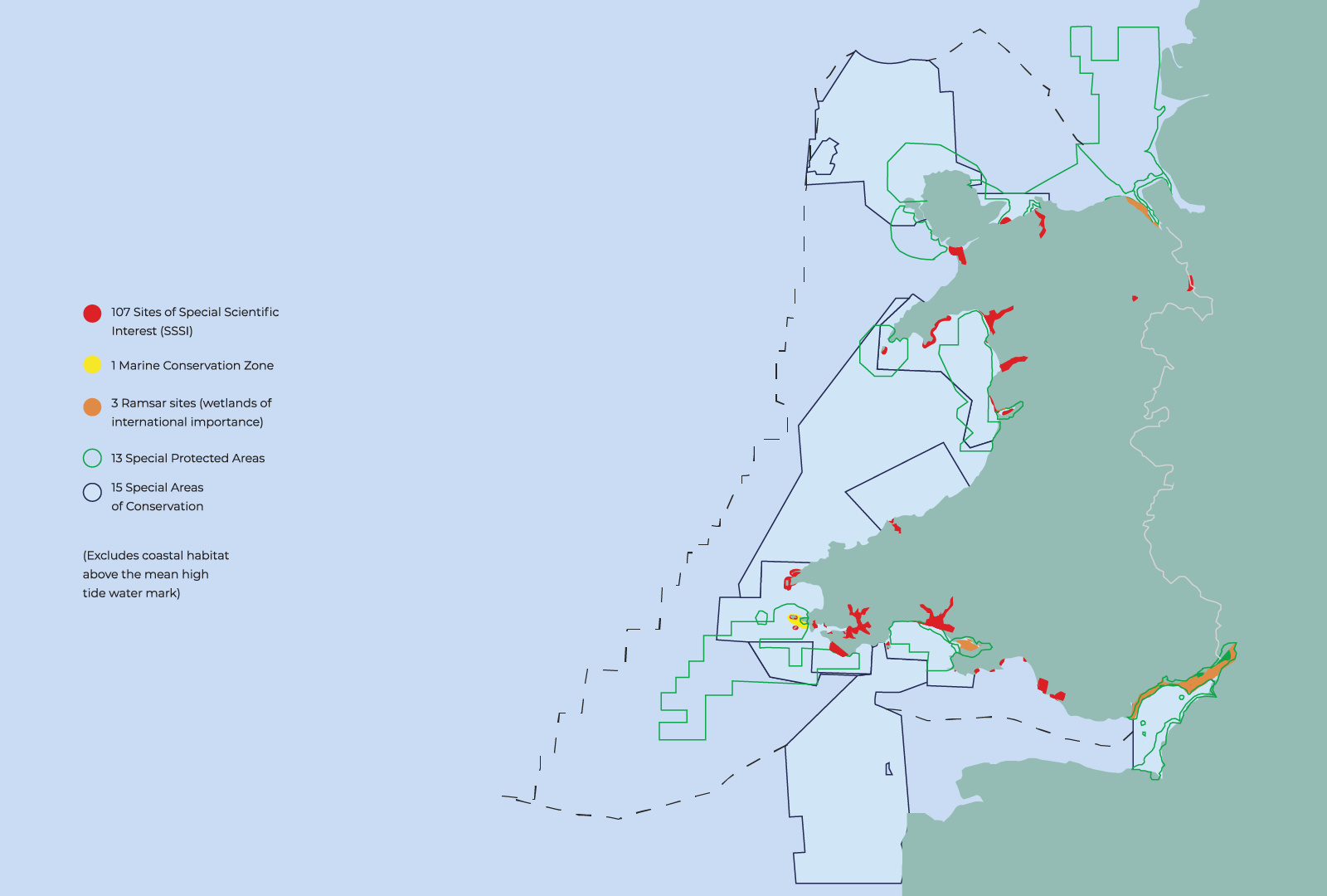
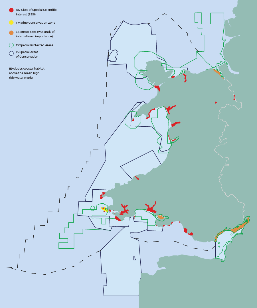
The image is a map of Wales and the surrounding waters showing designated marine and conservation sites.
The legend identifies the following designations:
- 107 Sites of Special Scientific Interest (SSSIs), shown in red
- 1 Marine Conservation Zone, shown in yellow
- 3 Ramsar sites (wetlands of international importance), shown in orange
- 13 Special Protected Areas, shown with green outlines
- 15 Special Areas of Conservation, shown with dark blue outlines
The mapped designations are distributed around the Welsh coastline, including north Wales, Cardigan Bay and the south Wales coast. Several designations extend offshore into marine waters.
A dashed boundary line marks the wider marine planning or jurisdictional boundary around Wales. The note on the map states that habitat above the mean high tide water mark is excluded. The image demonstrates the concentration and distribution of protected marine and areas around Wales.
Climate Adaptation Strategy for Wales
The Climate Adaptation Strategy for Wales aims to keep land-based, freshwater, marine and species and habitats in good ecological health and resilient to the impacts of . The strategy also covers infrastructure, flooding and adaptation approaches.
This includes:
- Keeping protected areas in favourable conditions
- Increasing habitat diversity, extent, connectivity and species-richness across all areas. This leads to more resilient ecosystems and fewer greenhouse gas emissions from natural stores (places in nature that can absorb and hold for a period of time)
- Using more , which are outlined in more detail in chapter 4.

National Strategy for Flood and Risk Management in Wales
This sets out a comprehensive approach and long-term measures for reducing the risk of flooding across Wales.
The strategy:
- Provides strategic direction through clear objectives and measures that help to reduce risk by building an area’s and encouraging collaborative working
- Focuses on delivering more sustainable schemes via and coordinated land and water planning
- Recognises the importance of clear advice on for Risk Management Authorities (see above) and communities, and the need to work closely with groups on shoreline management plans.
Shoreline management plans
Shoreline management plans help communities prepare for the changes ahead. It’s about building , so when flooding does occur, we can learn to respond and recover quickly to reduce the chances of negative long-term effects.
Who’s involved?
Risk Management Authorities whose members include Welsh Government, Natural Resources Wales, local authorities (acting as Lead Local Flood Authorities) and water companies with a responsibility or interest in managing the coast then help to deliver the aims of the National Strategy for Flood and Risk Management in Wales for Government.
The Welsh Groups’ Forum – made up of groups with interest in the coast – then create the shoreline management plans (there are four that cover Wales), and oversee their production and quality. Shoreline management plans are owned by groups, and signed off and approved by Welsh Government. In the Dyfi, we’re part of the West of Wales Group which includes local authorities (Gwynedd, Conwy, Ynys Môn, Ceredigion and Pembrokeshire), Natural Resources Wales, Network Rail and other maritime operating organisations. The group manage the shoreline between St Anne’s Head in Pembrokeshire and the Great Orme in Conwy.
To learn more about adaptation and Shoreline Management Plans, see Chapter 5.
Chapter Seven:Blue carbon
Blue is dioxide that’s absorbed from the atmosphere and stored in the ocean’s plants, rocks and sediment. Storing this helps to fight the effects of .
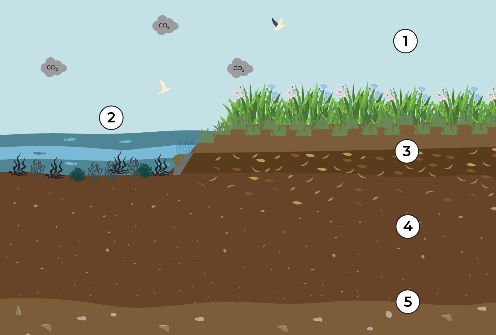
Blue mitigates
Plants remove CO2 from the air through photosynthesis Saltmarshes also trap carbon-rich sediment and organic matter from tides Removed carbon is stored in plants until they die Dead plants are buried under sediment decomposing slowly Carbon is stored in soil for thousands of years
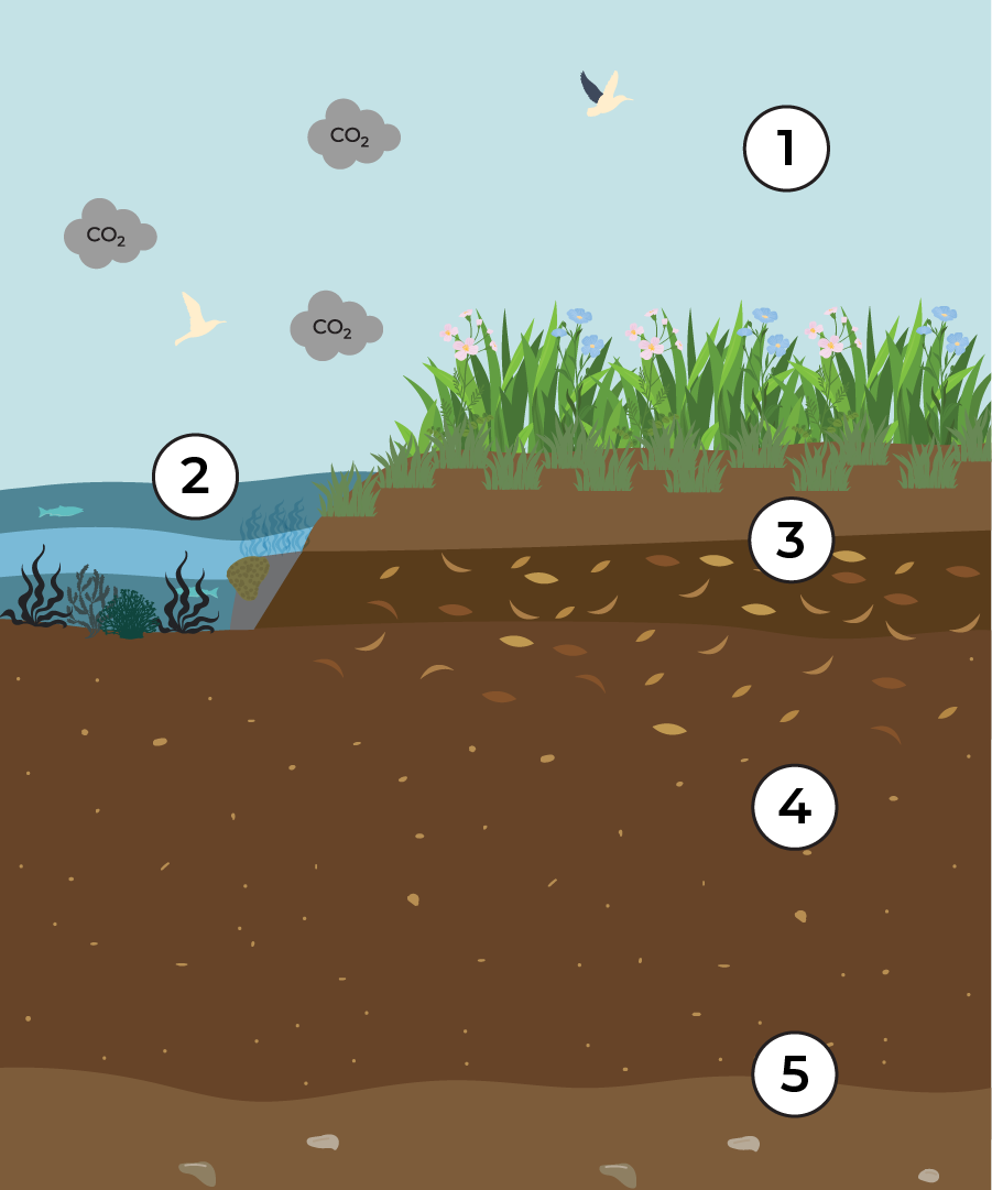
The image is a cross-section of a salt marsh ecosystem showing how is captured and stored over time. The numbers correspond to the following processes:
- dioxide in the atmosphere: dioxide (CO₂) is present in the atmosphere above the salt marsh.
- removal through photosynthesis and tidal input: Salt marsh plants remove CO₂ from the air through photosynthesis. Salt marshes also trap -rich sediment and organic matter carried in by tides.
- stored in living plants: The captured by plants is stored in their leaves, stems and roots while they are alive.
- Burial of dead plant material: When plants die, their remains are buried beneath layers of sediment. They decompose slowly in the low-oxygen conditions below the surface.
- Long-term storage in soil: Over time, accumulates and is stored in salt marsh soils for thousands of years.
How our region measures up
Long-term stores are an estimate natural systems such as oceans, forests and soils, which lock away for more than 100 years.
The and Welsh Coast Region – which the Dyfi estuary is a small part of – covers an area of 43,112 km2.
Of this area, 31,177 km2 (72%) are designated as Marine Protected Areas (which include Marine Conservation Zones, Marine Nature Reserves, Special Areas of Conservation, Special Protection Areas and marine areas of Sites of Special Interests and Areas of Special Scientific Interest).
In total, there are an estimated 15.7 million tonnes of long-term stores of , with 93.7% of that total stored within just the top 10 cm of sublittoral mud and sand/mud seabed (sublittoral mud is a seabed habitat made of fine sediment that’s always covered by water).
Which means this estimate represents only a fraction of the overall stored in the full thickness of these . It’s the top layers of , however, that are the most recently deposited and the most at risk to disturbance by human activities.
An estimated 0.94 million tonnes of are stored in the top 10cm of soils in saltmarshes and 0.06 million tonnes in seagrass bed .
Living kelp biomass contains an estimated 204,000 tonnes of organic carbon
With an additional 8,800 tonnes contained in intertidal microalgae.
Sublittoral Marine Conservation Zones and Special Areas of Conservation contain the largest proportion of organic and inorganic (6.4 metric tonnes). But inshore, littoral Marine Protected Areas (which are those areas close to the land) and notably the smaller marine portions of Sites of Special Interests, have the highest densities and rates of accumulation per unit area in their muds, saltmarshes and seagrass beds.
Marine Protected Areas with predominantly rocky habitats have less longterm stores and lower accumulation rates. But they do support extensive that contribute to neighbouring areas of sediment through the and transport of kelp detritus.
The information in this chapter is taken from The United Kingdom’s Blue Inventory: Assessment of Marine Storage and Sequestration Potential in UK Seas (Including Within Marine Protected Areas). This report summarises the original analysis undertaken by the Scottish Association for Marine Science (SAMS), The University of St Andrews and the Marine Biological Association (MBA). It has been written and edited by Professor Dan Laffoley and Professor John M Baxter, WWF, The Wildlife Trusts and the RSPB.
These are the different types of blue found across the UK. Seabed are the world’s largest repository of , extending over 360 million km2 of the Earth’s surface
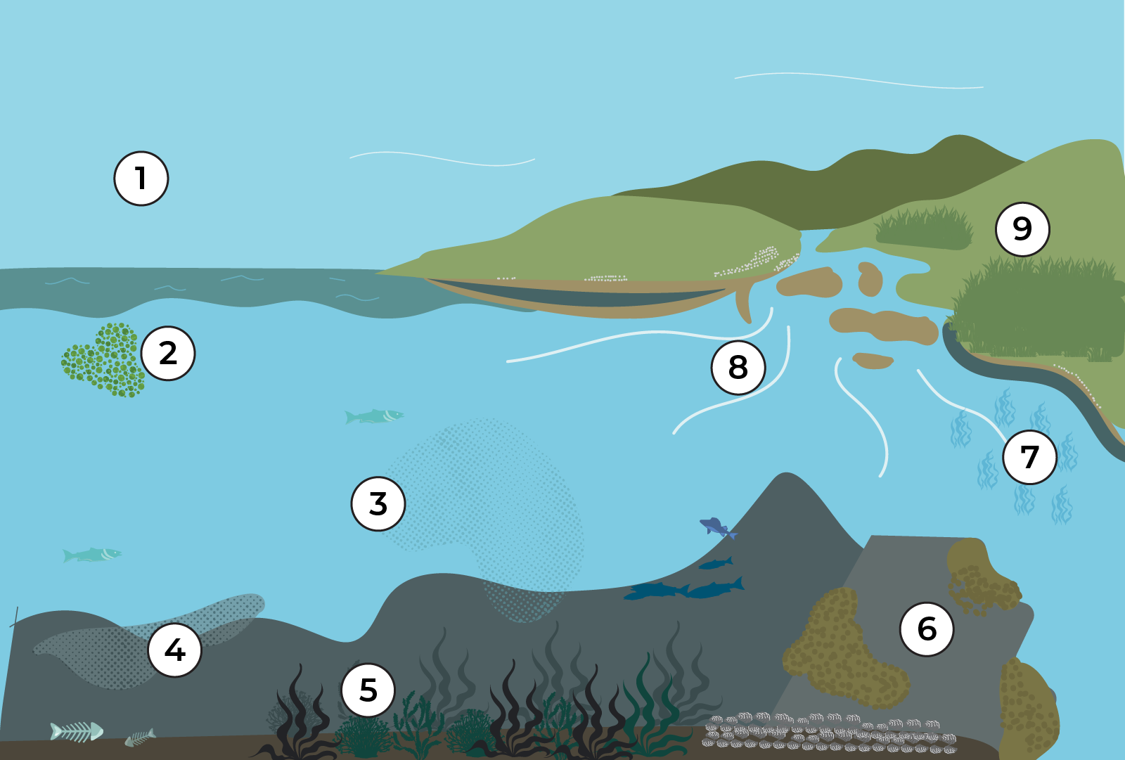
The image is a cross-section of and marine ecosystems illustrating how moves and is stored in blue habitats.
Each number corresponds to the following process:
Atmospheric carbon Excess dioxide in the atmosphere is driving
Ocean plankton Microscopic marine algae near the surface of our seas capture through photosynthesis
Sea of carbon particles Algae, suspended , and fragments of seaweeds and other plants feed larger animals and add to blue stores
Carbon reaches the seabed Particles from the sea of are deposited and buried on the seafloor. Dead sea creatures add to it
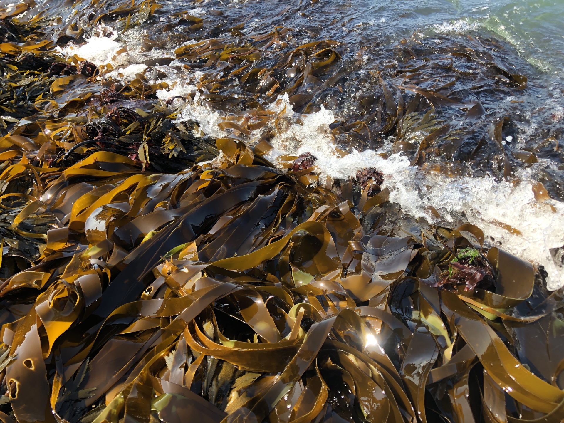
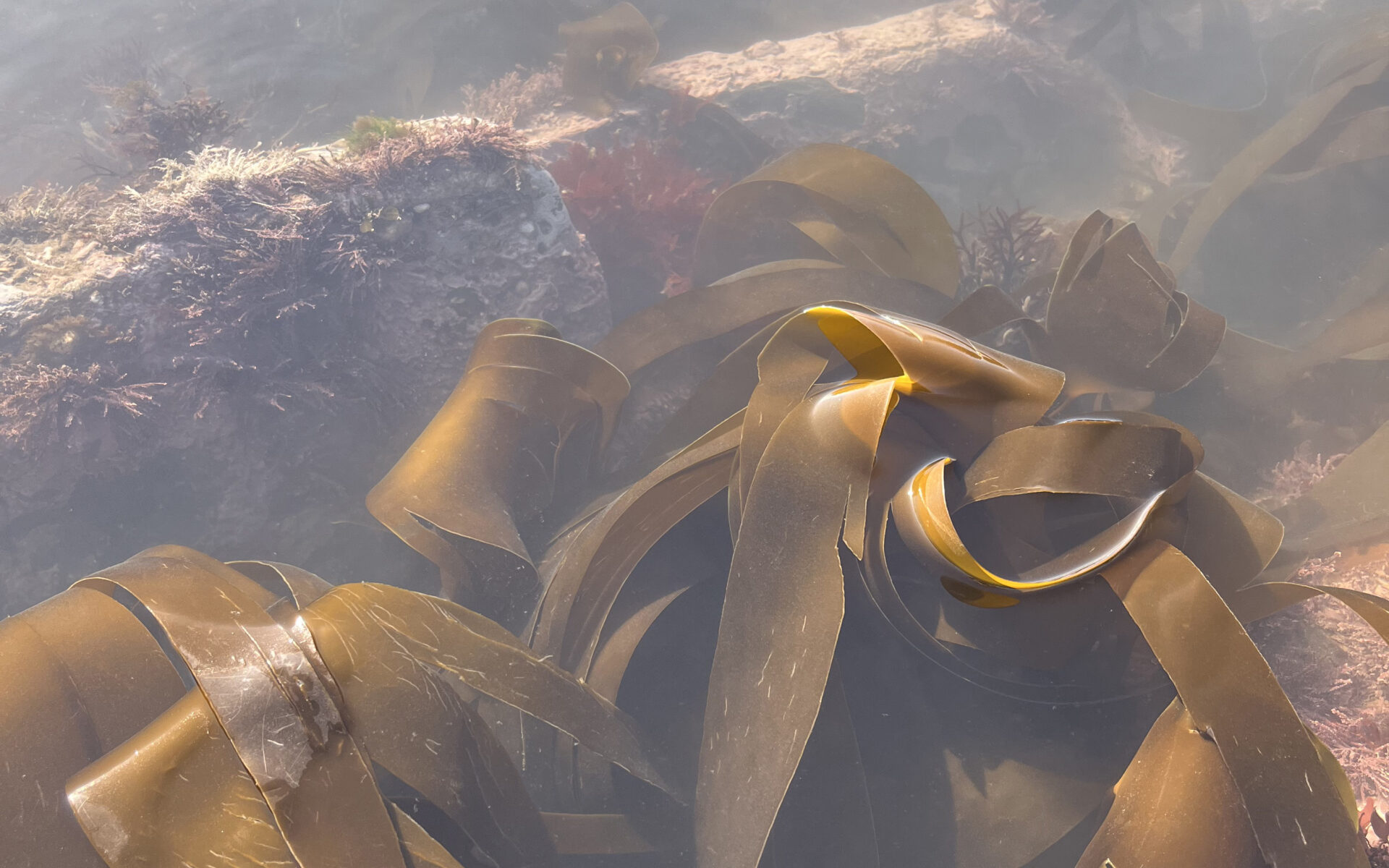
Kelp forests Kelp and other seaweeds capture via photosynthesis, a proportion of which is exported and buried elsewhere
Biogenic reefs Biogenic reefs such as corals, oysters and mussel beds trap and store in their structures
Seagrass Seagrasses capture via photosynthesis and store it in the sediment below
Run off from land Rain and rivers may wash off land (e.g. by eroding ) and into our seas
Saltmarsh Saltmarshes capture through photosynthesis and store washed in from sea and land
The diagram demonstrates how moves from the atmosphere into marine and ecosystems, where it is captured by plants and algae and stored long-term in , seabeds and reef structures. This long-term storage of in and marine habitats is known as blue .
How much is down there?
The within just the top 10cm of seabed has been estimated.
We have estimated the tip of the iceberg
Seabed in UK waters are thousands of metres thick in some places. It is the top layers that are the most at risk from the impacts of human activities
The image is a three-dimensional cutaway block illustrating the structure of the seabed beneath waters.
The top surface shows the ocean with a small boat on the water and a section of coastline at the left edge.
Below the water surface, the block reveals two main geological layers marked with numbers:
- Bedrock: The lower grey rocky layer represents bedrock. This is the solid underlying geological foundation beneath marine .
- : The thick brown layer above the bedrock represents seabed . These extend vertically from the seabed surface downwards and can reach thousands of metres in thickness in some locations.
extend thousands of meters thick in places
Just in the top 10cm of the UK and Isle of Man seabed there are 244 million tonnes of carbon locked away.
Broken down into long-term stores
240 million tonnes In seabed
2.4 million tonnes In habitats
139,000 tonnes Of seagrass meadows
Short-term stocks
1.4 million tonnes Of kelp forests
67,000 tonnes Of seaweeds
Threats to blue
Protecting blue is crucial. While significant progress has been made in recognising the role of land-based ecosystems (like forests and peatlands) in fighting by storing , blue remains undervalued. And it’s largely unprotected within Marine Protected Areas (MPAs), despite its importance.
Marine planning isn’t working effectively to protect our crucial blue stores and hasn’t accounted for the significant role seas play in storage.
Failing to recognise, protect and manage blue habitats leaves them vulnerable to activities that can disturb, damage or entirely destroy them. The single greatest and most widespread threat to these stores is the physical disturbance of the seabed caused by human activities at sea, such as bottom-towed fishing and offshore developments.
Assessment of these risks is not currently covered by marine planning laws. Key research generated by The Wildlife Trusts, World Wildlife Fund and RSPB advocate a reduction in these damaging activities to help protect our marine stores.
Graphic is reprinted/adapted from the Blue Report produced by The Wildlife Trusts, WWF and RSPB (2024) @danhilliarddesign
The image is a cross-section of the ocean showing offshore activities and their impacts on seabed stores and marine ecosystems. The scene includes vessels, offshore wind turbines, marine wildlife and disturbed seabed .
Each numbered marker corresponds to the following
Multiple activities threaten marine wildlife and blue carbon. Marine planning fails to prioritise nature and climate, and there is currently no incentive for activities to minimise their impacts on blue carbon habitats Developments at sea result in as yet unquantified disturbance and/ or loss of carbon rich sediments. Bottom-towed fishing gear can penetrate the seafloor, disturbing carbon-rich sediments and potentially releasing carbon to the atmosphere, worsening climate change. Many of our MPAs do not have adequate management measures in place, leaving the blue carbon within them at risk from damaging activities
The illustration shows sediment plumes rising where the seabed is disturbed, highlighting the potential release of stored from marine .
Protecting our superheroes
Blue projects are efforts to protect and restore habitats – like salt marshes and seagrass beds – that are excellent at soaking up and storing dioxide.
These projects do much more than just help the environment. They look at the big picture, addressing the need for supportive government policies, money and funding, and ways to improve local economies and jobs. The goal is to create the right conditions for these crucial ecosystems to survive and thrive.
There are a few examples of blue community projects going on in the UK:
The Rememare project in England aims to restore at least 15% of estuarine and habitats along the English coast by 2043. In practice, this means it needs to restore at least 55 km² of and 6 km² of seagrass meadows to achieve its mission. There are so few native oyster reefs left that there isn’t a focus on one area. So, instead, it’s promoting restoration action in as many locations as feasible.
What is blue ?
Blue is simply the way we pay for these projects. It’s a special kind of funding that supports the protection and recovery of our -storing habitats.
This type of funding is unique because it must:
- Measure carefully: It calls for special ways to track and count the amount of stored in areas.
- Handle tricky issues: It addresses unique challenges, like figuring out who owns the land/sea and planning for the effects of sea level rise.
- Combine funds: It mixes money from credit markets (where companies pay to offset their emissions) with traditional conservation funding.
- Plan for change: It must account for how these habitats might shift or move as coastlines change over time.
Much of the financing research and development relies on unlocking private finance as businesses become more motivated to voluntarily offset CO2 emissions via the voluntary market.
What is Wales doing?
In Welsh seas, there is huge untapped opportunity for businesses, industry and a wide range of stakeholders to demonstrate commitment to environmental and enhancement. A collaboration of organisations is seeking to afford Wales this opportunity via the creation of the MARINE Fund Cymru.
The Fund is being developed through the Wales Coasts and Seas Partnership’s (CaSP Cymru) Blue Investment Working Group, with the support of Wales Council of Voluntary Action (WCVA), an experienced grant manager.
The
There are several areas of blue currently being developed, with the leading the way. The code is likely to work along similar lines as the existing Woodland Code and Peatland Code.
The aim is to create and use frameworks for landowners, organisations and businesses to restore and create in order to address .
Guidelines for funding projects
Blue offers great promise and opportunities, but we still need clear rules, better science and fair community agreements before investors can fully jump in.
This has led to the development of guidelines for responsible funding of projects by The World Wildlife Fund (WWF) that use nature, like blue , to tackle . These guidelines emphasise protecting and managing large, interconnected areas – both on land and in the ocean.
Much of the information for this chapter has been drawn together from the brilliant research and advocacy work being delivered by World Wildlife Fund, Wildlife Trusts and RSPB.
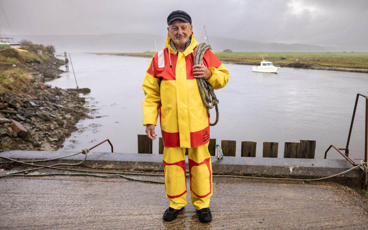
Chapter Eight:Local voices
Kirsti and Catrin from our co-design group travelled around the Dyfi estuary to listen to the people directly affected by the changes and challenges facing our area. Their diverse ideas, hopes and fears have been captured in a series of interviews, a snapshot of which has been published here.
We hope that by gathering this lived experience we can make more practical and informed choices together.
We’ve also been collaborating with a group of young people to create a short film about the Dyfi Estuary. It’s a chance for them to show what they love about the estuary, alongside their vision for its future. (CY)

Eluned Besent

Bronwen Hugil and Flora Fowles
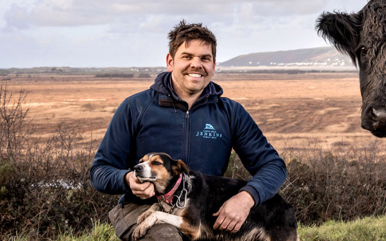
Geraint Jenkins

Caroline Stockford
Charlie Bartlett
Jill Hulse
Owen Jenkins
Chapter Nine:Recommendations
Adapting to the future will mean combining short-term, practical household and community preparedness with longer-term planning. It will need to embrace natural processes as often as possible, strengthen natural buffers and sensibly use engineered defences – but only if they can be justified.
Protecting natural archives of environmental change and supporting habitats such as saltmarshes and bogs are not luxuries. They are part of a resilient strategy that aligns with how the Dyfi coastline has always evolved.
Here, we outline our recommendations to help communities in the Dyfi Estuary and plan, prepare and adapt for what lies ahead.


Actions for our communities and individuals
Below is some practical, evidence-based actions to reduce risks and increase our in the face of accelerating and flooding.
We have based these recommendations on an understanding of the region’s ancient coastline and its influence on flooding. They are aligned with a modern, comprehensive plan for managing the risk of flooding.
Understand where water wants to go River terraces, ancient river paths (termed palaeochannels), peat and tell you where water will concentrate during floods.
Local historic maps, British Geological Survey and Natural Resources Wales flood maps, and community knowledge (which fields flood and how often) are essential. Land that sits on older raised gravel terraces drains differently than land that sits on low lying peat or an alluvial floodplain.
The Natural Resources Wales flood maps use cutting-edge technology and science. First, Lidar (laser scanning) is used to create a highly detailed map of the land’s shape and elevation. Then, hydrological models estimate how much water enters rivers during rainfall, while hydraulic models show how that water moves across the coastline and floodplains.
To plan for the future, these models are adjusted to include scenarios – such as projected sea level rise, heavier rainfall and more frequent storms – based on the latest UK Climate Projections. This combination gives communities a clear picture of current and future flood risks.
Plan for multiple futures Flood risk planning should consider a range of sea level rise and rainfall scenarios. Official planning and mapping from Natural Resources Wales and local authority flood risk management plans are a good starting point for householders, planners and community groups.
Take measures to protect your property and community Community flood plans
Local flood action groups, clear evacuation routes, local alerting systems and refuge locations (arranged in advance) can reduce the risk to life and speed up recovery.
Borth and Ynyslas have published a community emergency plan, which includes information on storms, power cuts, prolonged snow and fire.
Learn more about flood warnings and alerts on the Natural Resources Wales website.
Protecting your property
Raise electrical points, install flood boards or demountable defences in the short term.
If it is cost-effective, use water-resistant materials at ground floor level. Make sure any insurance coverage takes into account official flood maps – these can be found on the Natural Resources Wales website.
You can find out more about what the main UK insurers will and will not cover on the Which? website.
Get help and support, before and after a flood
The National Flood Forum is a charity that helps, supports and represents people at risk of flooding.
They offer specialist flood recovery services, information and advice (including how to cope after a flooding disaster), professional training and work with communities to empower them to reduce their flood risk.
Floodmart.com, a US-based online hub, offers advice on flooding, including 12 ways to emotionally recover after a flood.
Who to contact during or after a flood
If your life is in danger Call 999
Check live flood warnings Visit flood-warning.naturalresources.wales or call the Natural Resources Wales
Floodline on 0345 988 1188 (24 hours a day)Report a gas emergency Call National Gas Emergency Service on 0800 111 999 (24 hours a day)
Report a water or sewer emergency Call Welsh Water on 0800 052 0130 or 0800 085 3968
Report a power cut Call 105 or visit powercut105.com
Check local road closures or request sandbags Call Cyngor Gwynedd Local Authority on 0176 677 1000 or Powys
County Council on 0159 782 5275 (out of hours).Report a blocked drain or surface water on a road Call your local council:
- Ceredigion County Council on 0154 557 0881 (during office hours)
- Powys County Council on 0345 602 7035
Report highway emergencies in Ceredigion (outside office hours) Call Ceredigion County Council:
- North Ceredigion on 0197 062 5277
- South Ceredigion 0123 985 1604
If your property has flooded or your vehicle was damaged Contact your insurers and follow their advice
You can also sign up for free flood warnings from Natural Resources Wales.

Actions for flood and managers, policymakers and practitioners
Policy, finance, planning and governance Here, conducting critical reviews, creating partnerships, securing funding and using the latest planning tools are key to drawing in funding from government, and lobbying ministers for the critical resource we need to support future adaptation
Target multi-benefit funding opportunities Seek integrated funding for projects that offer multiple benefits, such as flood risk reduction, improving nature and restoring peat.
Use planning tools to avoid any mistakes Strengthen local planning policies to steer new building projects away from high-probability flood zones and require climate-resilient standards for any permitted development.
Conduct monitoring and reviewing Embed periodic adaptation reviews (for example, every five years) that update assumptions, incorporate new projections and adjust pathways. Incorporating transparent, -led review processes help to build legitimacy and flexibility
Adopt scenario-based regional plans to 2075 and beyond Use UK Climate Projections (UKCP18) and the Welsh regional sea level allowances to evaluate a range of futures and stress-test designs to 2075 and beyond.
Local authorities and National Resource Wales must include sea level allowances and regional guidance in local flood risk management plans and any decision-making to avoid locking in new development in high-risk zones.
Design for flexibility and incremental adaptation rather than single, irreversible solutions to avoid any regrettable investments.
Create catchment partnerships Expand and formalise partnerships that include National Resources Wales, local authorities, Dyfi Biosphere, farmers, utilities and community groups. This is so they can better coordinate natural flood management, modelling and mapping of contaminated river channels and floodplains, and strategic .
Prioritise nature-based and hybrid solutions As much as possible, restore saltmarshes, dunes and peat as living, , and use engineered structures selectively if need protecting.
Restore saltmarshes and dunes
Allowing space for saltmarshes and dunes which attenuate wave energy and trap sediment to migrate inland (where feasible) increases long term .
– where land is allowed to revert to habitat – is already a recommended option in many UK estuaries and may be appropriate for parts of the Dyfi where long-term protection is not possible. This approach needs to be carefully managed in close collaboration with local landowners whose livelihoods depend on this land.
Conserve peat and bogs
Maintaining Cors Fochno and the surrounding bogs keeps peat functioning as water storage. It also reduces flooding and protects nature.
Evidence from the peat record also argues for protecting these archives as they contain long records of past storm events.
One example of this conservation work is taking place in the Elan Valley, where two successful restoration projects are helping to stop the of peat and protect 28 hectares of blanket bog.Conduct natural flood protection measures
Planting leaky dams and restoring woodland and riverbanks can slow flow, retain sediment and reduce downstream . They are most effective when applied in combination and across many small upland sub-catchments – and when landowners are involved.
Work at
River flood risk, sediment supply and contamination originate upstream. -scale natural flood management and land-use measures reduce , trap sediment and deliver biodiversity co-benefits. Measures like restoring woodland introducing sustainable grazing for livestock – can help reduce .
Evidence from local initiatives, such as those at Pennal and Talybont, demonstrates multiple local benefits when farmers and communities lead projects.
However these schemes need to be mitigated with other defences in catchments with drainage areas greater than 10km2, as they do not offer protection or reduce the severity of the effects of larger floods, such as the event in Ceredigion June 2012.
Infrastructure design and maintenance It is crucial to protect the Dyfi Estuary’s infrastructure and design engineering solutions that are adaptive, easy to maintain and ecologically friendly.
Maintain critical infrastructure
The Aberystwyth-Machynlleth railway line runs through low-lying and river valley areas, making it highly vulnerable to . Rising sea levels and more frequent, intense floods will increase the risk of embankment breaches, track washouts and service disruptions.
For local communities, this means reduced reliability for commuting, tourism and emergency access – potentially isolating villages and impacting livelihoods. Without major adaptation measures, such as strengthening embankments or raising sections of track, these disruptions could become more frequent and severe, affecting both the economy and daily life in the Dyfi valley.
Find the key roads and utilities (like the A487 road, bridges or water treatment works) that would cause a large ripple effect if they failed. Protect them using better designs, raised roads and stronger sea walls built for future water levels.
Avoid blanket hardening of the coast (which uses materials like rock, concrete or steel), which can cause habitat loss.
Implement design standards that allow for adaptation
Engineering designs should allow for design structures that can be raised or taken apart later (in modular parts with sections that can be replaced easily), using materials and shapes that reduce maintenance and ecological impact.
Protect and manage sediments carefully There are several ways to keep contaminated sediment, river channels and floodplains in check.
Map and monitor contaminated mine waste and tailings (fine grain residues generated from the milling process of mining operations)
Create a prioritised inventory of legacy mine sites and downstream contaminated river channels and floodplains.
Fix or secure high-risk mine waste piles (spoil tips) by planting vegetation or building protective structures to stop contaminants from spreading in the future.
Produce risk maps for communities and farmers living on contaminated floodplains.
Assess sediment quality before any work takes place
Environmental Impact Assessments for any new project that disturbs floodplains or tidal muds must assess metal concentrations and pathways to avoid disturbing any polluted sediment.
If disturbing the sediment is unavoidable, create and implement containment, remediation or safe disposal measures.
Fixing key upland waste will reduce any future pollution. New modelling and mapping tools can help locate contaminated river channels and floodplains, as well as offer clear guidance on how to manage them.
Monitoring, data and warning systems Improve tide and river-level gauges, upland rainfall networks, and sediment and water-quality sensors in key tributaries.
Use combined river-tide forecasting models to give accurate compoundevent (when several flood drivers happen at once i.e. storm surge from the sea during high tide and river flood, which can increase the effects of flooding) warnings. You can learn more about flood warnings and alerts on the Natural Resources Wales website.
Create community-accessible visual data maps and clear local guidance. Real-time information strengthens our community’s response and supports local decision-making.
Community-level preparedness and social resilience This is all about making sure communities are ready for change and have a say in how decisions are made.
Community flood plans and property adaptations
Strengthen local flood action groups, produce rehearsed evacuation plans, identify community refuge sites and priority-access routes, and promote property-level measures (raised electrics, demountable barriers, flood-resilient materials). Decision-making must be participatory and transparent.
Encourage homeowners to take steps to insure their properties, while also lobbying for fair insurance arrangements.
Support for people and their livelihoods
To help those people whose homes and farms can no longer be protected, we need a fair, long-term approach that helps them relocate as well as compensates them for their losses. This plan also needs to determine how to strategically move sea defences back – all in way that protects communities and preserve social cohesion and local economies.
Cultural heritage and natural archives of environmental change The Dyfi catchments peatlands, floodplain and estuarine store ancient records of past sea level change and human activity.
Any adaptation projects – especially , dredging or floodplain work – must factor in archaeological surveys and monitoring to record threatened heritage.
By working with universities, museums and heritage groups, we can protect historical sites. This involves selective excavation, protecting other sites where they stand and educating the public to show that saving these sites form part of your planning.
Actions for the next five years
In the short term, here are five of the most critical actions that flood and managers, policymakers and practitioners can use to support our communities
Update local risk assessments Use the latest UKCP18 sea level inputs and Natural Resources Wales flood mapping. Identify those areas most at risk, including infrastructure, communities and contaminated sites.
Map legacy mine contamination of river channels and floodplains Prioritise stabilising old waste heaps (spoil-tips) where they are most likely to erode. Also focus on creating management action plans in communities and farms located on contaminated floodplains
Scale-up natural flood management and peatland restoration pilots Build on Pennal 2050 and Talybont projects, with evaluation metrics for sediment trapping, biodiversity outcomes and how beneficial they are to the water systems.
Develop community adaptation packages These include leaflets, property grants, evacuation rehearsals and strengthening flood-warning reach.
When the cost of coastal defence becomes too great to maintain, move sea defences inland (strategic realignment) This mean finding new sites, determining who owns the land and arranging how to compensate them.
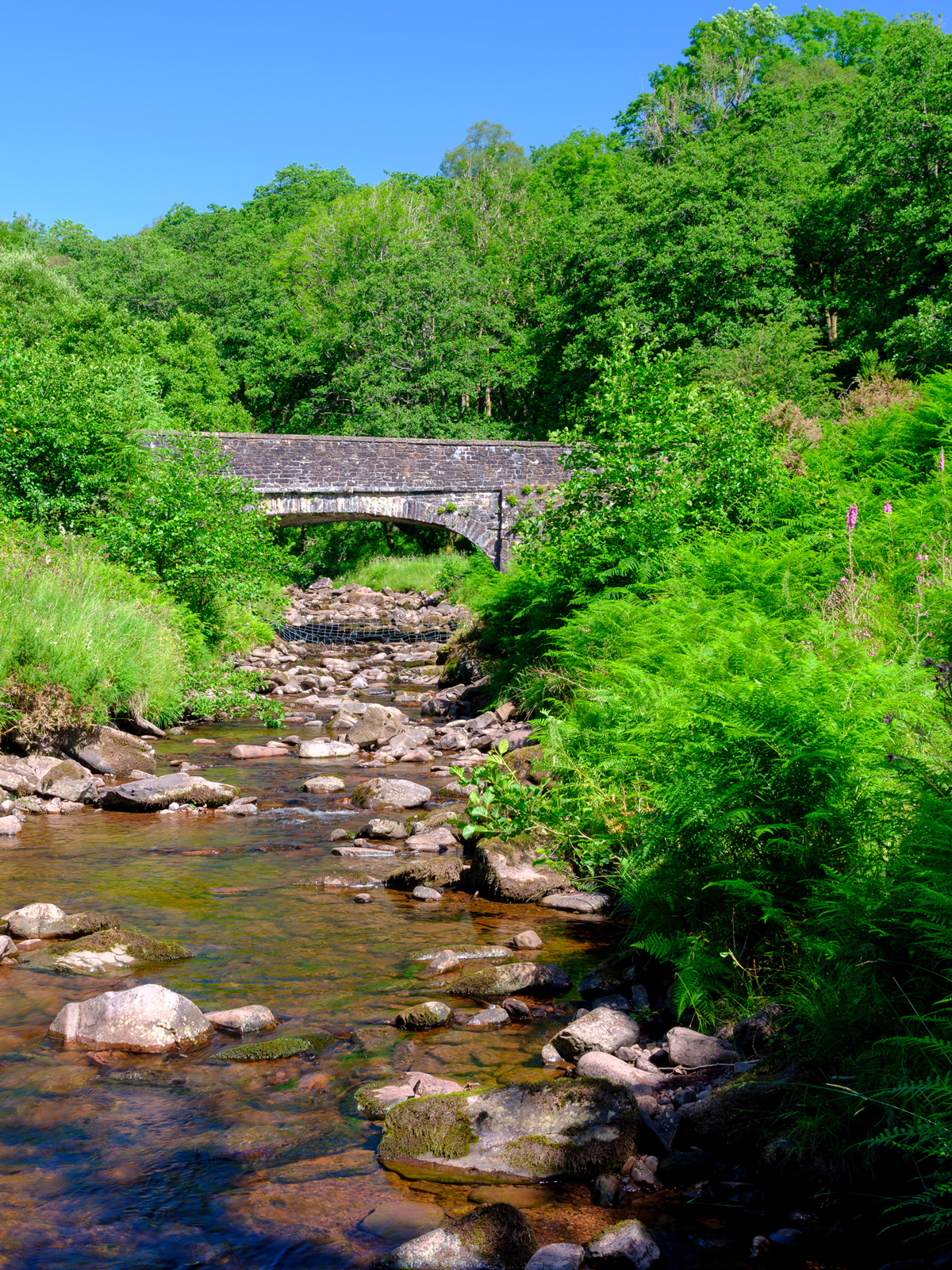
Examples of in the Dyfi
Here are two examples of how communities in the Dyfi are putting plans in place right now.
The village of Talybont, where the Afon Ceulan and Leri meet, was very severely affected by flooding in June 2012. In the aftermath, Talybont has demonstrated a and an ability to adapt to local level flooding by forming a community flood group, the Talybont Floodees.
The group provides support for people whose homes have been flooded (or are at risk of being flooded). The Talybont Floodees also began a major tree-planting programme in the Ceulan and Leri catchments upstream of Talybont to try to reduce runoff and river flow.
On the north side of the Dyfi valley, the award-winning and farmer-led Pennal 2050 Natural Flood Management Project is running an ambitious programme managing land and stream , runoff and flow across more than 7,000 acres. Learn more about this project on GOV.UK.
Chapter Ten:Concluding thoughts
We hope that the insights we gathered over the last 18 months, drawing on the expertise and lived experience of local people, will inspire residents around the Dyfi Estuary to take action in the face of the changes and challenges ahead.
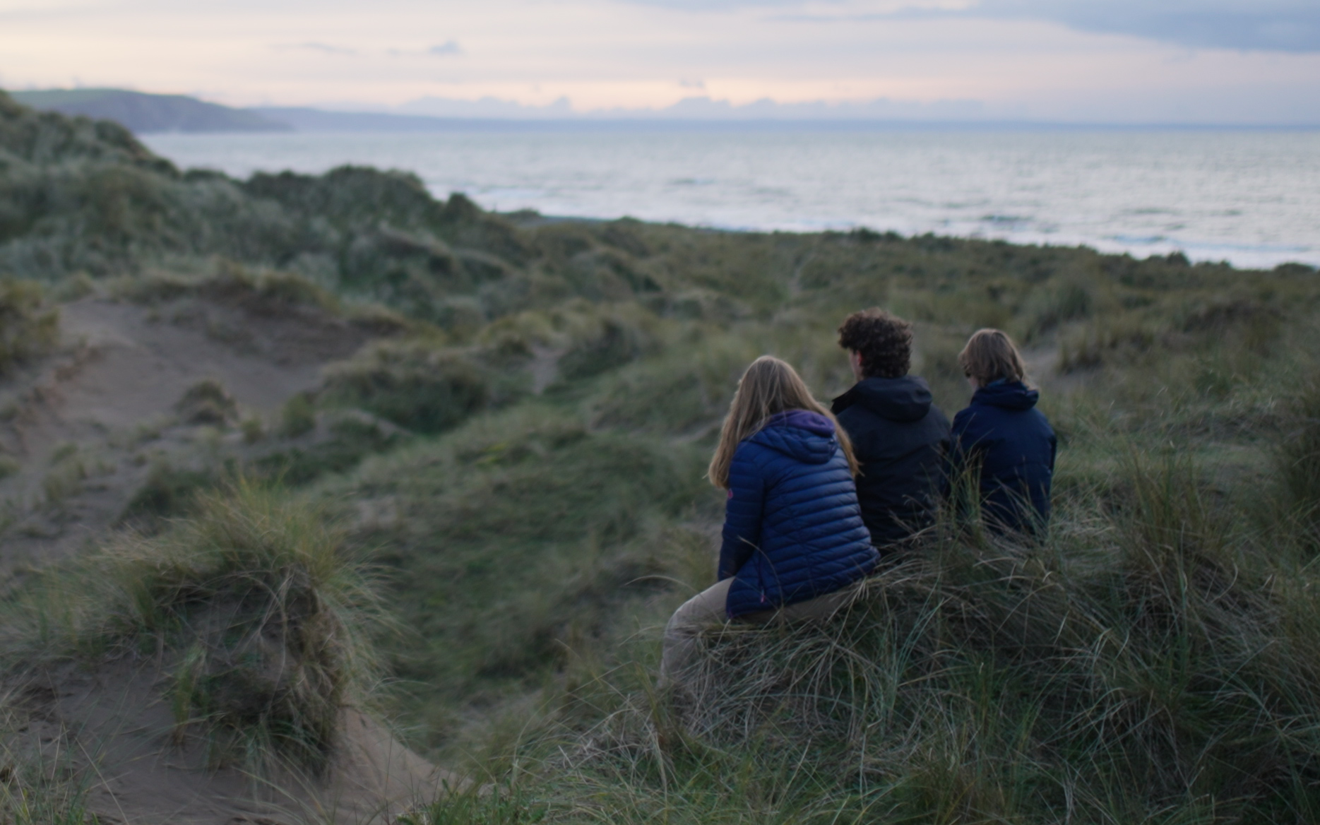

Life on the coast has always meant living with constant change. The history of the Dyfi, from meltwater rivers to today’s shifting marshes, dunes and channels, shows that coastlines are never fixed.
Some changes unfold slowly, as seen in peat and sediment records; others arrive quickly and reshape daily life. Scientific understanding helps us recognise which parts of the coastline are naturally dynamic, which are vulnerable, and which offer natural protection – all knowledge that strengthens our ability to adapt.

By sharing what we have learned about the land, habitats, history and communities of the Dyfi, we hope this handbook becomes a practical tool: a resource that enables you to ask better questions, prepare more effectively and push for the support we need to adapt our systems for what is to come. Shared knowledge is a form of .
Preparing for the future means combining practical, short-term steps with longer-term planning that works with natural processes. Protecting heritage and habitats is not optional – it is part of how is built.
We are resourceful and resilient people, used to living on the edge and at the ‘end of the line’. But we refuse to be sidelined in the fight for the future of our communities and resources. Other communities in Wales and beyond face similar pressures, especially those in dynamic estuaries or short, steep catchments. This handbook can serve as a starting point for them too – a shared reference that supports wider conversations.
This is a call to action: to stay informed, to organise and to speak up for what our communities need. And this handbook is not the end of the discussion. It is one step in an ongoing conversation, because we live on a coastline that is always changing. Our understanding, our planning and our community response will need to keep adapting with it.
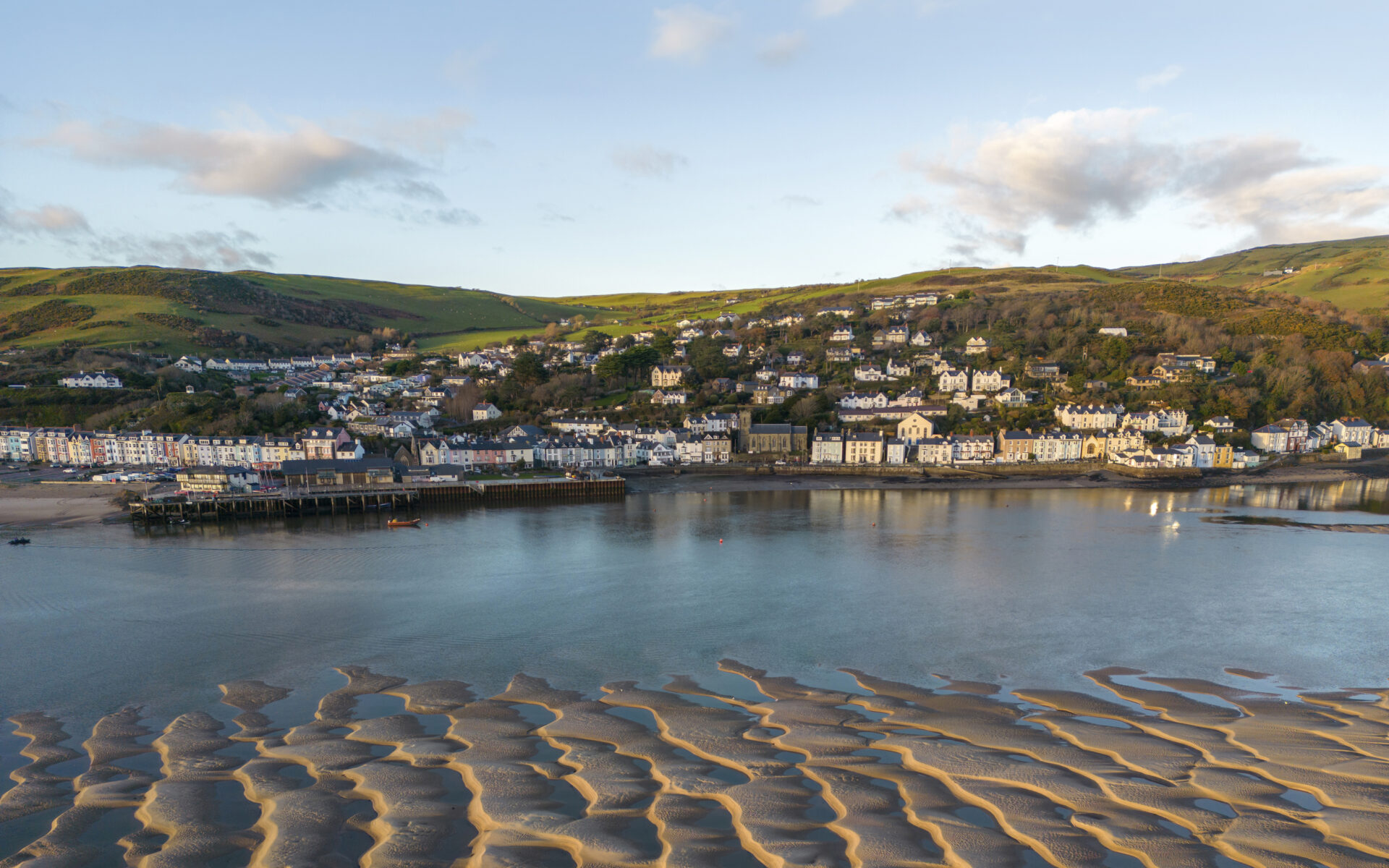
Beyond the project: How we’ve changed
We asked a few members of our co-production group if there was anything they’re thinking or doing differently as a result of their involvement with Changing Tides. Here’s what they said:
The project has helped me to understand many new issues that I was not aware of with regards to coastal adaptation. It’s been great to see what other communities in the area are already doing to be prepared and help themselves when an incident happens. That has inspired me to see what can be done within my own community.
Since my involvement with Changing Tides, when driving in the Dyfi Valley and along the coastal roads, I find myself considering the height the land is above the sea/river level. And then thinking of the impact a relative small increase in tidal levels will have on the surrounding area: farmland, on transport (roads and the railway), people’s houses and lives.